
Features
Expanding and developing Wilpattu National Park, its many attractions


Excerpted from the authorized biography of Thilo Hoffmann by Douglas. B. Ranasinghe
Wilpattu is the largest National Park of Sri Lanka, with extensive parts in both the North Western and North Central Provinces. A large section of the present Park was established as a Game Sanctuary in 1909, and became the Wilpattu National Park in 1938.
Along its periphery were several Intermediate Zones and Sanctuaries, with a lower status of protection. By the mid 1960s Thilo strongly held the view that these were outdated and had to be incorporated into the respective National Parks, if they were not to be lost as conservation areas. Though they were effective buffer zones, in the eyes of most people they served only the interests of the small shooting fraternity.
Through the WNPS, as its Secretary, Thilo managed to convince the authorities, and in 1967 most Intermediate Zones, including those of Wilpattu South and Wilpattu East, were incorporated into the adjacent National Parks. Also absorbed into National Parks were most of the protected areas with the status of Sanctuary which bordered on them, as these had allowed free access.
Thilo believed that the large and very important Wilpattu West Sanctuary, bordering the sea on its further side, had to be amalgamated with the Park. During his term as President, the Society took up the idea and steadily agitated for it. The area could not be incorporated at first due to the presence in it of a few privately owned blocks of land, at Pomparippu, Kumburavi, Pallakandel and Vellamundel.
By the competent efforts of the then Director of the Wildlife Department, Mr S. D. Saparamadu, land in exchange was found at Vanativillu which satisfied the owners. (See also p.99.) Thilo’s proposal was thus put into effect. It has been described as one of the most important measures since the establishment of National Reserves.
This permitted the completion of Wilpattu National Park, by the relevant Gazette notification, dated December 9, 1973. Today, the total area of the park is 1,309 square km with a sea frontage of 48 km.
During that decade and the next Thilo proposed the extension of the Park into the sea to include Portugal and Dutch Bays and the Karaitivu Islands. This measure would have protected a valuable marine habitat, as well as the threatened sea animal, the dugong, now practically extinct in Sri Lankan waters.
This entire area has a very fragile ecosystem, which is unable to survive the massive human interference and touristic development which has recently been planned for it. Its protection should be strengthened, not weakened.The best known features of the Park are the villus, which contribute much to its beauty. Forty-four have been identified, of which 27 may be called small lakes. Thilo explains:
“The villus in Wilpattu are very shallow depressions of the land in which surface run-off water collects. Most of them have a natural overflow. For example, these flows are visible between Timbirivila and Borupanvila, and from Kumbukvila to Kokkari Villu. The only villus with no such overflow are Lunuvila and Kokkari, and at Dematavila it occurs only in very wet seasons.
“Rainwater, which when it falls is similar to distilled water, collects from the soil during run-off mineral salts containing calcium, potassium, sodium, etc. and carries the dissolved salts into the villus. During the drought much of the water evaporates. This occurs year after year. In the few villus which have no overflow the water becomes increasingly salty. In the others during the rainy season the surplus water washes out the excess minerals.
“Some time ago a foreign team of researchers wrote a paper on Wilpattu, in which they said that villus are caused by groundwater seepage, and that they are groundwater lakes. This wrong statement has entered the international literature.
“Just near Panikkar Villu there is a 40-foot-deep well, which in 1976 had only a handful of water collected in a depression at its bottom; we used it for drinking and washing during our weekend visits. At the villu there was yet some open water surrounded by deep mud. This shows that the water in the villu has no connection with groundwater. Villus are not more than two feet deep. Their bottoms are covered with a thick layer of soft mud, over an impermeable layer of clay, which prevents percolation in either direction.”
Thilo has a special liking for this Park, which he knows intimately. He was much concerned in 1976 when an unprecedented drought struck it. In consultation with the Wildlife Department the Society worked out an action plan to mitigate the effects. Again, Thilo explains:
“The drought at Wilpattu caused most of the villus to dry out completely. The large Kokkari Villu was reduced to a small pond with a fringe of deep black mud. I realized later that animals, especially sambhur, did not so much die from lack of water but from drinking toxic salt water when only the salty villus Kokkari and Lunuvila still held any water. Other animals died getting stuck in the deep mud which surrounded the drying-out villus.
“During any drought elephants and bears dig their own waterholes, elephants with the help of their trunks and bears by digging with their forepaws. Other animals such as barking and mouse deer, mongooses, etc. make use of these holes. Elephants can dig down to 2-3 feet. Bear dig to 4-5 feet down in sandy soils. But in 1976 the drought was so severe that the water table had gone down well below these levels.
“Therefore, we dug a number of water holes and managed to get water at seven to eight feet in sandy areas, e.g. near Manikapola Uttu. Holes were also dug by us at Dangaha and Etambagaha Uraniyas and at Kina Uttu which had gone dry. Water bowlers were brought up from Colombo and filled at Kala Oya. We then regularly filled oil drums cut in half lengthwise and buried all over the park in the dried-up villus. A. Baur and Co. Ltd contributed generously towards this project. Every Friday evening after work I drove up to Wilpattu and returned to office on Monday mornings. On Saturdays and Sundays we worked hard to provide relief I submitted a written report on each visit.”
Dr C. G. Uragoda in his book Wildlife Conservation in Sri Lanka (1994) writes:
“With the help of bowsers and tractors some 60,000 gallons of water were made available to animals in August, September and early October when fortunately the rain came. ‘The President Mr. Hoffmann personally supervised this major undertaking, spending almost every weekend in the Park.”
An interesting feature was the discovery at two places far apart, Nelum Wila and Mana Wila, of the remnants of many golden palm-civets. They are mainly nocturnal and thus rarely seen; they had been killed by leopards.
Thilo also noted that spotted deer can stand extreme droughts. In the Western sector of the Park these animals were in fine condition despite the total lack of water for weeks and miles around. Obviously they obtained sufficient water from the early morning moisture condensed on grasses and leaves.
During droughts elephants and buffaloes move to permanent sources of water, such as rivers.
Buffaloes were quite numerous in Wilpattu. The existence in Sri Lanka of the true wild buffalo is controversial; most are feral. Farmers in jungle areas would allow their animals to freely roam in the forests and open spaces, where they would mingle and mate with the wild stock.
They had wooden bells tied to their necks so that they could be found again. These were made of hollowed out blocks of the very hard and dark red palu wood (rarely also satin and other hard woods) with clappers of deer horn and the owner’s initials or brand marks carved in them. During the recent lengthy periods of abandonment of the Park the buffaloes of Wilpattu were nearly exterminated.
For decades, peril from man has threatened the Park. An ancient Dutch track, very rarely used, traversed the coastal section of the Wilpattu complex between the rivers Kala Oya in the south and Modaragam Aru in the north. This is an area of special importance. It provides a link to the sea for the rest of the Park, and is the abode of the elephants of Wilpattu.
In 1961 there was a proposal by the Army to rebuild the road. This would have severely affected the entire Wilpattu National Park. As a result of representations made by the Society the proposal was dropped. In 1982 a new wide Army road was built further west from Elavankulam to Mail Villu. The Society protested against it successfully.
The author learnt of the following detail not through Thilo but another person present on the occasion. This is an example of information forgotten or modestly omitted by him: see Chapter XI. The Society’s then President, Dr Ranjen Fernando and Thilo, its last, were called to a meeting of the Defence chiefs by President J. R. Jayewardene. The Army Commander spoke of the desirability of the road.
Thilo believed, then and afterwards, that a coastal road beween Mannar and Puttalam would help the LTTE more than the Army. With the President’s permission he put one question to the General: “Who controls the road between Mannar and Wilpattu?” The answer was: “The LTTE.” Jayewardene immediately ordered that the road through Wilpattu be abandoned.
In March 1985 Thilo and Mae drove to Wilpattu – as often before. When they did this they never neglected to pay homage to God Aiyanar in the customary manner. Mae insisted on it. The Deity’s domain is the northern jungles which are entered on crossing the bridge over the Deduru Oya north of Chilaw. By smashing a coconut at the little shrine here and by placing a freshly broken twig in the fork of a tree the God’s protection is solicited.
On two fateful days they were the only visitors in the Park. The first evening, Thilo saw and photographed on the beach at Karuwalakuda a group of men with fishing boats and nets. The episode is described in the Foreword to this book (page xi).
It was an LTTE killer squad, led by a man called Victor, which had come from Mannar by boat. During the night they moved through the Kala Oya estuary to Elavankulam where they hijacked the early morning bus. Driving through Puttalam the armed group reached Anuradhapura around 6 a.m. There they massacred a large number of civilians including Buddhist monks. They then sped back to Nochchiyagama, and across the Park to Pukulam in its northwestern corner, where around noon the same boats waited to take them back to Mannar, then in Tiger hands.
Within Wilpattu they murdered in cold blood over 20 staff and labourers. Range Assistant H. H. Bandara and Bungalow Keeper Tennakoon were forced to guide them, and both then shot dead on the beach.
The Hoffmanns were staying at the Talawila bungalow. Around lunch time on the second day the news of the massacres and the presence of the Tigers in Wilpattu reached it by radio. The staff and some Park workers there panicked, and pleaded that they should all flee in the Land Rover to Aliyawadiya, on the Kala Oya, many miles south.
After a difficult journey over long-abandoned jungle tracks, which Thilo fortunately knew, via Galge Viharaya and Makalanmaduwa, they reached their goal in the evening. They crossed the river, and found shelter for the night at the Kala Oya Hotel (now no more). A curfew had been declared in the District.
The following morning Thilo went back, now via the main road, to Talawila, to retrieve some overlooked items. At the Hunuwilagama entrance to the Park he had to await the arrival, 24 hours after the events described, of army and police personnel, and then he followed their convoy as far as the centre of the Park.
Mae was convinced that God Aiyanar had protected them.
(To be continued)
During the years that followed, the Park was closed and abandoned. Animals in it were slaughtered, especially buffaloes, wild pig, sambhur and deer. All the visitors’ and staff bungalows were ransacked and largely destroyed by roaming poachers, criminals and timber thieves.




Rajan Philips
The second anniversary of Anura Kumara Dissanayake’s election as President has come and gone, but not before getting marked by a spate of judgements delivered and announced on a single day following the anniversary. Far away in New York, it has been a week of speeches by state and government leaders making their pilgrimage to the 81st Annual Sessions of the United Nations that is entering its ninth decade. President AKD did not make the trip this year to the UN Sessions, which are now reduced to being a convenient meeting place for world leaders to hold sideline meetings on bilateral as well as other contentious matters.
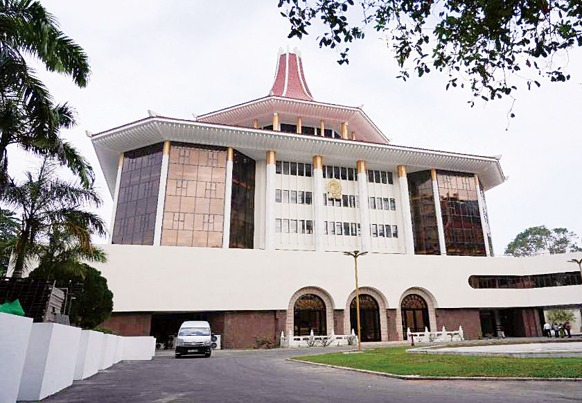
Sri Lanka is not in the crosshairs of any such contentions, but there are enough internal crosshairs that the NPP government and a feckless opposition are constantly trying to avoid. The day of judgements too has come and gone. All in all, it was a good day for the NPP government, at least in the sense that the government suffered no reputational damage from any of the three judgements. There were two Supreme Court rulings, one on the bill for the 22nd Amendment to the Constitution and another on the constitutionality of the Anti-Corruption Amendment Bill. The third court ruling was the verdict given by the Colombo Permanent High Court following the Trial-at-Bar of 24 people accused for their role in the 2019 Easter attacks.
Easter Justice
The three trial-at-bar judges, Navaratne Marasinghe, Ramanathan Kannan and Sujeewa Nissanka, reached a unanimous verdict and found 15 of the accused guilty and found the other nine not guilty and released them forthwith. The accused were spared of the death sentence, but the lengths of rigorous imprisonment sentences are just as bad. One was sentenced to 260 years, four got 240 years each, five 220 years, and another five 200 years. In addition, the court ordered the instant confiscation of the movable and immovable assets of all 15 found guilty.
The verdict marks a substantial milestone in the search for justice on behalf of the victims of the Easter attacks. The government can claim some political credit for the conclusion of the trial after seven years of fits and starts, and high level stymying under three presidents who preceded President AKD. Much greater credit of course belongs to the hundreds of law enforcement officials who built up a mammoth case of 23,270 charges against 25 suspects (one of whom died in hospital during the trial) and won convictions of 15 of them.
But this is not the end of the journey for those seeking Easter justice based on the whole truth. There are other trials going on and the elusive mastermind is yet to be found. Mohammed Ibrahim Mohammed Nawfar (alias Naufar Moulavi) is one of the 15 convicted by the Permanent High Court. Naufar Moulavi was identified in May 2021 as the mastermind by the Gotabaya Rajapaksa government. The government claimed that FBI investigation had confirmed it. This claim is not supported by the FBI affidavit filed by agent Merrilee R. Goodwin in a US Court in California, in December 2020.
The purpose of the FBI affidavit was to support the indictment of Mohammed (Moulavi) Naufar, Mohamed Anwar Mohamed Riskan and Ahamed Milhan Hayathu Mohamed “for conspiring to provide, providing, and attempting to provide material support to a foreign terrorist organization, namely ISIS” (Islamic State of Iraq and al-Sham), in violation of US laws. But neither Naufar nor the other two were identified as masterminds. The only mastermind identified in the affidavit is “Jahran Mohamed Cassim, also known as (“aka”) Mohamad Cassim Mohamad Zahran, aka Zahran Hashim (“Zahran”). Zahran killed himself in the suicide bomb he detonated, along with scores of victims, and spared himself from earthly trials.
To close the loop on this, the three men identified in the FBI affidavit, namely, Moulavi Naufar, Mohamed Riskan and Ahamed Milhan, are among the 15 convicted by the trial-at-bar High Court. But their conviction does not bring closure to the enduring question whether there was a political mastermind(s) behind the 2019 Easter attacks. There is still no clarity on what the former Attorney General Dappula De Livera publicly alluded to as evidence of “a grand conspiracy behind the attacks that killed 269 people and injured over 500.”
That was on 18 May 2021, and the statement was a follow up to the letter that Mr. De Livera had written on the state of the police investigations, to then Inspector General of Police (IGP), the late C. D. Wickramaratne. Mr. De Livera soon went on to retire after a remarkable prosecutorial career, and reportedly turned down the government’s offer of appointment as High Commissioner to Canada. Mr. Wickramaratne himself has since died under rather tragic circumstances.
Those who allege that the Catholic Church is making unproven allegations about Easter attacks masterminds, conveniently gloss over the fact that the Church is not accusing anybody of being a mastermind, but is only asking for a thorough inquiry that will put to rest, once and for all, the perennial question about the Easter mastermind. The difference now is that after suffering frustrations with three presidents and their governments, the Church is experiencing a positive response from the current president and his NPP government.
Amendment Politics
Aside from the lawfare politics of the Easter attacks, the politics of the 22nd Amendment to the Constitution is running its course after the Supreme Court ruling that a referendum is not required for the amending bill to become law, but only a two-thirds majority in parliament. The ruling was widely expected but not because of some ‘fix’, but because it would have been silly to find a judicial reason to have a referendum on the retirement ages of judges. This is not to absolve the government for its missteps on this matter and for putting everyone through months of constitutional contortions. Rather it is to highlight the absurdity of getting exercised virtually over every constitutional amendment and insisting that enacting the amendment without a referendum is tantamount to an assault on democracy. The referendum requirement has become a constitutional curse.
The 1972 Constitution of the First Republic had a very straightforward amending procedure with no referendum requirement, so straightforward that JR Jayewardene was able to throw out a whole (1972) constitution lock, stock and barrel, and replace it with his new constitution of a totally different (presidential) persuasion, simply through a parliamentary select committee process and a two thirds majority in parliament. No one called for a referendum to justify so momentous a change, but now a referendum is required to determine at what age a superior court judge can retire. Nonetheless, as President Jayewardene’s admirers and followers celebrate his 120th birth anniversary, there is no gainsaying that regardless of whether one agrees or disagrees with his presidential achievements and legacies, JR Jayewardene was without question the most consequential political leader of Sri Lanka in the 20th century.
In the 21st century and on the 22nd amendment, with no referendum required, the Bar Association is changing tack and calling on parliamentarians to vote with their conscience, without toeing the party line. After Friday’s vote, it may want to poll the MPs to find out who among them voted listened to their conscience, and who toed the party line. The Association may be having a difficult time going through the withdrawal syndrome after months of heightened exertions. As for the opposition and Sajith Premadasa, the latter has simply promised that a future SJB government will repeal the 22nd Amendment. To what end? To reenact another episode of confusion and distraction.
An Economynext commentator has described the Supreme Court ruling on the referendum requirement for 22A, as being “surgical in its constitutional analysis.” Well said. The ruling plausibly addresses every good and bad argument that was flung at the judges and demonstrates, citing copious precedents, that at the end of the day, no matter who the individual judges and their abilities are, and what anyone thinks of them, the ‘Court’ can find its collective voice and express itself with clarity and authority.
The same Economynext commentary interprets the 22nd Amendment as “a foundational prerequisite for operationalizing the newly enacted, stringent Anti-Corruption Act, which is a key commitment of the government era for the IMF.” The commentary suggests that “multiple clauses in the 22nd Amendment are designed to satisfy governance and anti-corruption structural benchmarks within the ongoing IMF Extended Fund Facility (EFF) agreement.” While noting the risk of scaring investors who might view 22A as being anti-democratic and antithetical to judicial independence, the commentary goes on to opine that the passage of 22A combined with a strong and systematic anti-corruption drive could be a boost to investor confidence, especially in the critical sectors of logistics, renewable energy and technology.
The above is an interesting interpretation even though I am not sure whether anyone associated with the government has formulated the intentions of the 22nd Amendment quite this way. Objectively, the argument is plausible and will justifiably rile the ire of the left opposition to the NPP government and its inclination towards the IMF. At the same time, there is no mistaking the government’s intention and determination to fight corruption in politics and public life. Apart from, or rather as part of, its arresting politics, the government is also going ahead with the passage of the Anti-Corruption (Amendment) Bill, which too has had its determination by the Supreme Court, albeit by a different three-judge Bench, almost concurrently with the 22A ruling by the five-judge Bench. The Supreme Court’s determination on the Anti-Corruption Bill was triggered after it was challenged by Transparency International Sri Lanka.
But unlike the SC ruling on 22A, the ruling on the Anti-Corruption Bill singles out a provision as requiring approval in a referendum for its enactment. The provision involves Clause 17 of the Bill which elevates the bail granting threshold for determination by a High Court and not a Magistrates Court as currently practised. The subject offence involves a bribe not less than Rs. 100,000, or causing a government loss of not less than Rs. 500,000. The Court held that such a change infringes the fundamental rights of citizens against arbitrary detention and will require a referendum approval. The Bill of course could be passed without a referendum after removing the specific provision. Remarkably, the government argued that the proposed amendments to the Anti-Corruption Act are necessary to remove current bottlenecks, achieve conformance with UN standards, and comply with the IMF program in Sri Lanka.
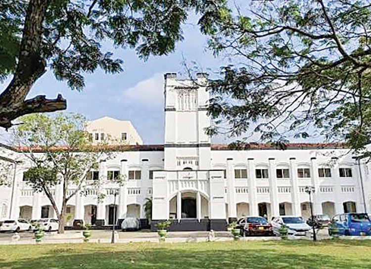
Little breathing space between papers at the final exam and my mind goes blank answering Sinhala paper
(Excerpted from The Art of Governance, autobiography of MDD Pieris)
Then came the final blow. When the time table for the final examination was out, I discovered that I would have to answer all my nine papers, of three hours each at one continuous stretch without even a half days break! I was due to answer the European history paper one afternoon; then go on next morning to British history; afternoon to Ceylon history; the next morning to English Poetry; afternoon to English drama; the following morning to English prose; and that same afternoon to suddenly switch from thinking and writing in English to thinking and writing in Sinhala, answering the first of the three papers in Sinhala, with the other two coming morning and afternoon the following day! Several of my friends urged me to go and speak to the university administration about a change, but at the same time, others who had had difficulties and sought recourse reported that they were rather rudely treated by the officers concerned.
This deterred me from going. I was a polite person by nature and just as in the case of Mr. Athulathmudali about whose insistence on politeness I have already written about, I too resented the prospect of being treated rudely. Therefore, I decided, quite foolishly no doubt, and come what may to go through and sit for the nine papers in four and half continuous days. Thus began the most difficult and harrowing period of my life, a period even worse than the experience at the university entrance examination.
In that instance, there was certainly disappointment and frustration but since I was attempting a near impossibility, there was less stress because mentally I was prepared for failure. This was reflected in a reasonably good appetite, and the ability to sleep. This time, at the final examinations, I lost both. Normal eating was impossible. My stomach was in knots. I just went through the motions and nibbled something and basically sustained myself with a combination of powdered milk and Ovaltine. Sleep became disturbed. After six hours of strenuous concentration a day answering question papers, there was little the mind could absorb by way of preparation for the next day.
During the day, nothing was possible since the morning’s paper was over at noon, and by the time you walked back from the Arts block to Marrs Hall just to look at the food and freshen up and then walk back to the examination hall to be there about 10 minutes before the 2 p.m. start of the next paper, there was neither time nor inclination to look at or absorb anything. I did try to look through whatever I could for the next days two papers during the night whilst keeping in mind the necessity to get some rest and sleep. Therefore, I did try to get six hours of sleep in the night. But it turned out to be an unhealthy and disturbed sleep leaving you not fresh, but jaded in the morning.
The mind was overactive. By this time, the numbers in the hall had dwindled due to the vacation. Only the few sitting for their final examination were in residence, and they were busy with their studies. There was therefore also a sense of loneliness and isolation prevailing. Added to all this was the horrible thought of failing and having to repeat all nine papers the following year. One had very much to try to find some degree of good cheer from within one’s own resources. Given my predicament I had precious little of that.
In these almost nightmarish conditions, I struggled through eight of the nine papers. The last paper during the final afternoon was the third paper in Sinhala literature, which was on prose. I still have a vivid memory of that afternoon. Rain clouds were building up and as we got down to answering the paper, it was getting quite dark. The lights shone brightly in the examination hall. There were five questions to be answered and I had just finished answering one, and had barely started on the next, when my mind went completely blank. I have never experienced such a thing before or since. The thinking processes suddenly stopped as if a plug had been pulled out from an electricity supply. I was in the middle of a sentence, I found impossible to complete. It was total disconnection.
There was just nothing I could do except to lay down my pen and gaze out of the window. There were two things in my favour at this critical moment. I possessed a temperament that didn’t panic easily or once embarked on a course, give up easily. I therefore calmly decided to stop trying to struggle, and relax. I was aware that precious minutes were ticking by. But I knew that what could not be cured must be endured, and that any attempt at force and struggle would only serve to aggravate the situation. That part of my mind was clear and rational. I spent almost 20 precious minutes doing nothing. Then gradually I found that I was able to focus once again.
I cautiously and with a degree of fear took up my pen and leaving room to complete the question I had begun to write on, started on a new question. The ideas flowed once again. I had however to be careful. There was no guarantee that everything would not come to a stop once again. I had already lost valuable time. Any further problem now would be the end of the paper and the end of perhaps the whole examination. I therefore deliberately slowed down my pace of writing and wrote slowly and steadily not pushing myself.
When the time came for the papers to be collected I had been able to answer only three out of the five questions in full. For the balance two, I was only just able to write down a few points. Answers in continuous prose were not possible. Up to this time, I had hope of at least passing the whole examination and obtaining my degree. Now, I was not so sure. There was a distinct possibility, I would fail the last Sinhala paper.
The next day I went home to Colombo, utterly drained. It appeared that my father’s prediction after reading my horoscope was not only accurate but frighteningly so. I too believed with him that there could not possibly be a worse period in the future. Starting from the stress of suddenly having to change schools in mid university entrance course to the end of my participation in school cricket through contracting measles, to the enormous trials and tribulations of the university entrance, to the disappointment of not being able to read for English “honours,” and now this situation at the final examination was almost too much for one person to take.
I was in a state which perhaps verged on a nervous breakdown, For a good two weeks at home, I was listless, unable to concentrate on anything. I could not read anything. Even the newspapers repelled me. The sound of music was irritating, and sleep desultory. I was taken to see the doctor, who advised complete rest. He did not give medicine. It was clear that I had severely overtaxed the system, and time would be the healer, as indeed was so gradually much to the great relief of my parents and myself. The newspaper once again began to interest me, and gradually books. Even then, I could not read for long periods for some time. I used to lose concentration and the mind began to wander.
In due course, I received a letter from the university, inviting me to teach an English course to the new batch of students about to enter the university. This was the vacation course in English for them. But I was just in no mood to teach. I was now back to normal, but did not wish to take upon myself the responsibilities of a teaching assignment. Therefore, I wrote back politely declining. But the letter from the university was a boost to my confidence. I knew that I would not have been called unless I had fared reasonably well, at least in my English papers, and got at a minimum a “B.” But what of the rest? I was still apprehensive. What came to mind was the unfinished Sinhala paper, and its possible impact on the whole examination.
Assistant Librarian Vidyodaya University
When the results came in due course, to my great relief I had passed. There was no question of a class. Nor was I expecting one. What I dreaded was sitting for the whole examination once again. I could now get this episode of my life out of the way and decide how to proceed. By this time the new Vidyodaya University had just begun to function. My father was a member of the Governing Council of the Vidyodaya Pirivena, the Vidyadhara Sabha and for long an associate and a friend of the renowned scholar Ven. Weliwitiye Soratha, the head of the Pirivena, who was the first Vice Chancellor of the new university.
Our family had many connections with Vidyodaya, including my maternal grandfather Mr. C. Don Bastian Jayaweera Bandara, himself a renowned scholar, writer, publisher and social worker, having had his higher education there. I for my part, for a period studied Sinhala under Ven. Soratha. Busy as he was, he found the time to teach me because of these family connections. I must have been a good student in his opinion, because he very graciously presented me a two volume set of his monumental work of the Sinhala dictionary, a task which he undertook and completed all by himself, a set which is one of my valued possessions even today.
When it became known that I had passed out, Vidyodaya was keen to have me and my father was equally keen that I should help out in whatever capacity. Finally, I was appointed as an Assistant Librarian and along with others, plunged into the task of setting up a proper library for the new university. At this time, the university functioned in the premises of the Vidyodaya Pirivena at Maligakande and it was rapidly becoming apparent that space was becoming a serious problem.
One of the most important tasks of a librarian is to classify knowledge accurately and correctly and this had to be carefully done. The system of classification adopted at the time was the Dewey Decimal System, and I spent much time at home poring over the volumes containing the system, so that during the working day classification and the typing of the card indexes, etc., could proceed with speed. Accuracy and speed were both necessary, accuracy, because a misclassified book is a lost book, speed because hundreds of books were lying on the floors, in cartons, in crates, on windowsills and all over the place.
I found the wide reading that I had done whilst at Peradeniya now of great assistance. With a quick perusal I was able to determine the classifications and sub-classifications. This was important. For instance, if one took up a book on European history, one had to determine whether it should be classified and appear on the shelves as general history; a history of a period; diplomatic history; economic history; social and cultural history; military history; a history of important treaties, and so on. This was so for all subjects and the wider your reading the easier it was.
But always at the end of the day was a general conference at which we took up for discussions amongst other matters, certain books which were exceedingly difficult to classify, partly because their contents approached the borders of many different subjects. Titles were frequently misleading. For instance, the book “Two eggs on my plate,” had nothing to do with cuisine. It was a tense memoir of certain military activities during World War II.
Three Maps of Ceylon Cinnamon
From the Pathfinder Collection
By Jennifer Moragoda
jennifermoragoda787@gmail.com
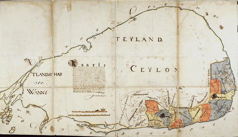
A remarkable Dutch map of Ceylon made in 1719 allows us to follow cinnamon through the country almost village by village.
Part of a series of thirty-six maps showing territories of the Dutch East India Company, it was drawn by Joannes van Campen and shows mainly the south-western portion of the island then under Company control. The twelve korales or provinces are distinguished by colour and extend, in the map’s description, from the river Caymelle to the Valave. Brohier notes that Caymelle was the Dutch name for the Maha Oya. A brown line marks the boundary of the Kandyan king’s territory. Within this political geography, a red line encloses what might otherwise be described simply as ‘Canelle Landen’: “the expanse of the luxuriant cinnamon bushes from the Chilaw river to the hook of Dondra.”
What makes the map extraordinary, however, is its detail. It marks the old administrative divisions through which the cinnamon country extended; villages and places associated with the seasonal work of the peelers; the forty-six numbered points along the annual route of the Cinnamon Captain; and the five coastal places to which the peeled bark was delivered.
Two further Dutch maps narrow the lens. A plan of Salpiti Korale maps cinnamon gardens and grounds among localities that are now part of greater Colombo and its suburbs. At an even more microscopic level, three drawings of a single chena near Hanwella represent individual trees by letters and colour and enumerate them.
Together they preserve an unusually detailed geography of Ceylon cinnamon and the enterprise built around it under the Dutch.
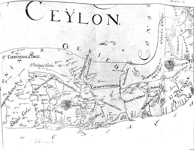
Van Campen’s map in facsimile M. F. N. Rotteveel’s 1901 facsimile of Van Campen’s 1719 map.
Much of that detail can be recovered today through the meticulous work of R. L. Brohier and J. H. O. Paulusz. Their descriptions and translations of Dutch maps and records provide the context that makes otherwise cryptic routes, symbols and localities intelligible.
A Circuit Through Cinnamon Country
Van Campen’s map immediately provides an overview of the country from which cinnamon was obtained. It is divided according to the old Sinhalese territorial and administrative divisions of korales and pattus. Many of their names, and the places associated with them, remain recognizable today, although their old boundaries are now less familiar. The map may surprise modern readers who are unaware that its cinnamon country extended as far north as the Chilaw River and south to Dondra.
The map also makes clear that the geography of cinnamon did not coincide neatly with political boundaries. It marks the limits of Dutch territory and the adjoining lands of the Kandyan king, while cinnamon also grew beyond Dutch-controlled territory. Access to cinnamon in Kandyan territory could therefore depend upon relations with the Kandyan court.
The most striking feature of the map is the minute detail with which this cinnamon geography is recorded. Forty-six numbered points trace the ordinary land route followed by the Cinnamon Captain, head of the Mahabadda or Cinnamon Department, on his annual general visitation at the commencement of the harvest. Starting from Colombo, his circuit took him north and then through a succession of korales to the south before he returned along the coast to Colombo.
The route recorded in Brohier and Paulusz runs through Negombo, Pittigal Korale, Hapitigam Korale, Sinna Korale, Rayigam Korale, Pasdun Korale, Wallalawiti Korale, Galle Korale, Beligama Korale, Morawa Korale and Dolosdas Korale, the latter embracing the Gangaboda and Welaboda Pattus of Matara and the eastern and western Giruwa Pattus of Hambantota.
On the map, the numbered stations allow that journey to be followed across the country. Even where individual names become difficult to decipher on a reduced reproduction, the extent of the circuit can be grasped.
But another set of small red circles gives the map an even more unusual human geography. In the words of its description, these indicate the villages and places “in which and near which” the cinnamon peelers commonly pitched their tents during the peeling season “in order to gather that costly bark.” These temporary encampments belonged to the older system of harvesting in which parties of peelers travelled through the cinnamon country, cutting suitable stems and bringing them back in bundles to be peeled and fashioned into quills.
The red circles are scattered through the cinnamon country densely enough that the map gives a visual impression of the scale of the seasonal harvest before one has deciphered every locality. J. H. O. Paulusz considered the map “of unusual value, indeed indispensable for studying the history of the Salagama community because it illustrates their manner of life, the districts in which they lived, and the hardships and dangers they endured.”
The Captain’s numbered route and the peelers’ encampments therefore record two related geographies. One is the official circuit of inspection. The other is the far more dispersed geography of the people actually gathering and preparing the cinnamon.
The map completes the picture by identifying five coastal delivery points—Negombo, Colombo, Beruwala, Galle and Matara—to which the peeled bark was “carried on their shoulders and transported with great labour.” Taken together, these details allow the old cinnamon enterprise to be visualized almost in motion: the Captain moving between his 46 stations; peelers establishing seasonal camps in and near particular villages; cinnamon being gathered and prepared in the surrounding country; and the finished bark moving towards five points on the coast.
The map also bears the letters A–H on a smaller circuit associated with Maradana, “where the best of that fragrant bark is peeled.” Brohier’s explanatory note identifies the area within this orbit as including Maradana, Wellicadde, Kirilepona and Bamblepitie—names recognizable today as Maradana, Welikada, Kirulapone and Bambalapitiya. These are now parts of a densely built city; on Van Campen’s map they belonged to the geography of cinnamon.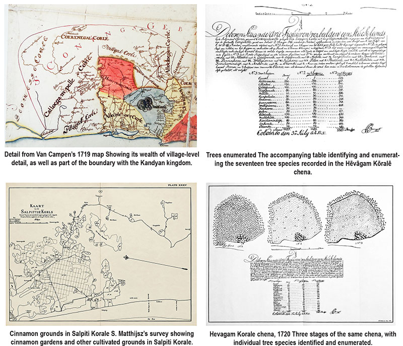
That juxtaposition is one of the pleasures of reading the old maps. Familiar names survive, but the landscapes attached to them have changed almost beyond recognition.
Salpiti Korale, Plot by Plot
A second map sharpens the focus further.
Where Van Campen’s map provides an overview of the geographical reach and movement of the cinnamon enterprise, the detailed plan of Salpiti Korale attaches cinnamon more closely to individual grounds and localities in and around what is now greater Colombo. Similar detailed plans were drawn for other korales and areas in which cinnamon grew.
The plate itself carries a striking collection of names familiar to a modern resident: Kotte, Mirihana, Welikada, Nawala, Pepiliyana, Kollupitiya, Wellawatte and Galkissa, or Mount Lavinia, among others. They appear beside or among numbered and outlined cinnamon grounds. The importance of the map is not that all of modern Colombo lay within Salpiti Korale—it did not—but that it allows particular 18th-century cinnamon localities around the expanding city and its eastern and southern approaches to be set against places we know today.
A related survey shows how closely Dutch mapping followed Colombo’s expansion. Brohier notes that, as settlement spread beyond the Fort and Pettah, a map made about 1766 by Lieutenant C. D. Wentzel surveyed the Colombo district for a radius of five miles in all directions from the Fort. Particular care was taken to mark the cinnamon-growing districts, partly for the information of the authorities and partly as a warning to inhabitants.
The records preserve some striking glimpses of areas we do not normally associate with cinnamon. A Dutch governor deplored the number of valuable bushes being “pitifully cut down for firewood especially near Liveramentu (Thimbirigasyaya-Narahenpita) where it grows luxuriantly.”
It is difficult now to associate Thimbirigasyaya and Narahenpita with luxuriant cinnamon, yet that is precisely why this cartographic detail matters. Pepiliyana, Nawala, Welikada, Wellawatte and other familiar names cease for a moment to be simply modern suburbs and become part of an older cinnamon geography.
In this sense, the Salpiti map performs a different task from Van Campen’s. The first shows the astonishing geographical reach of the cinnamon enterprise. Salpiti brings us down almost plot by plot.
Down to the Individual Tree
A third example reduces the scale to a single piece of ground. Three charts dated 1720 depict a chena called Katugalavila in the village of Degambedda in Hevagam Korale, about half an hour’s journey from the fort at Hanwella. The original survey was by L. Boomgart; the version reproduced by Brohier and Paulusz is an 1899 facsimile by M. F. N. Rotteveel.
The three drawings show the same ground before clearing, after cutting and burning, and after planting and regrowth. Seventeen kinds of tree are identified by letters, with their Sinhala names recorded in Dutch spelling. Before clearing, the plot contained five cinnamon trees; in the third stage it contained 229 cinnamon shoots and young trees. Brohier called the plan both “a picture of the ground” and a “working-plan,” and remarked on its striking representation of detail and use of colour.
This small survey is useful here chiefly because it shows just how far Dutch cartographic attention could descend: from an extensive cinnamon country, to individual grounds, and finally to individual trees.
The 1719 map shows the cinnamon country extending from the Chilaw River to Dondra. The Salpiti Korale map brings us into recognizable localities around Colombo and its suburbs. At Degambedda, near Hanwella, the cartographic lens descends to a single chena and finally to individual cinnamon trees.
Taken together, the three maps turn the broad designation Canelle Landen into something much more precise: a country of rivers, political boundaries and old administrative divisions; roads, villages and seasonal encampments; identifiable cinnamon grounds; and, finally, individual plants.
They also help explain the practical appeal of later attempts to concentrate cinnamon production in more accessible and systematically cultivated grounds. Van Campen’s map makes visible the enormous geographical reach of the older, dispersed system—the distances travelled, the seasonal encampments and the labour required to bring the prepared bark to the coast. The hardships of that system are less visible on the map itself, but they are amply recorded in the contemporary documentation. The later transformation of cinnamon cultivation is another chapter. These maps preserve the geography that preceded it.
Retracing the Circuit
There is a modern postscript to this story. In recent years, the Pekoe Trail, a long-distance walking route through the tea estates of the hill country, has offered a new way of experiencing Ceylon’s montane landscape and tea heritage. The Cinnamon Captain’s circuit suggests the possibility of a low-country counterpart.
It need not be a walking trail. Selected stages of the forty-six-point circuit could be retraced largely by road, linking surviving place names and old cinnamon localities with places where cinnamon is still cultivated today. The korales no longer function as administrative divisions, roads have changed and much of the old cinnamon country has been transformed or built over, but enough of the underlying geography survives to make the old route intelligible.
Three centuries ago the circuit was travelled at the commencement of the harvest by an official inspecting the cinnamon country. Retraced today, it could offer a way of rediscovering a geography that these extraordinary maps have preserved in remarkable detail.
Notes: This article draws extensively on Volume II of R. L. Brohier and J. H. O. Paulusz’s Land, Maps & Surveys: A Descriptive Catalogue of Historical Maps in the Surveyor General’s Office, whose detailed descriptions, annotations and translations of Dutch maps and records make it possible to reconstruct much of the geography discussed here.
Images 3–5 reproduced from R. L. Brohier and J. H. O. Paulusz, Land, Maps & Surveys, Vol. II (1951).

Buttler out of Oval decider as Lawrence earns ODI call-up

Showers will occur in the Western, Eastern, Uva and Sabaragamuwa provinces and in Galle, Matara, Kandy and Nuwara-Eliya districts.

Nor’easter brings flooding as New York and New Jersey declare emergency 2 hours ago

Trump rejects Iran deal to reopen Strait of Hormuz in seven days

Govt plans to hire 121,000 state workers, redistribute tax revenue

Parliament clears 22A amid protests

‘Dates have the highest sugar content to fight Coronavirus’

Sunday Island 27 December – Headlines

#SundayIsland 17th December – Headlines

Sunday Island – 28th March

Sunday Island Headlines – 21 March

Sunday Island – 21st February – Headlines
-
 News6 days ago
Hatton youth protest against reported death sentence for Lankan in Saudi Arabia
-
 News4 days ago
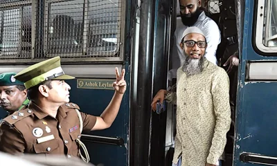
Mastermind Naufer Moulavi among 15 found guilty
-
 News5 days ago
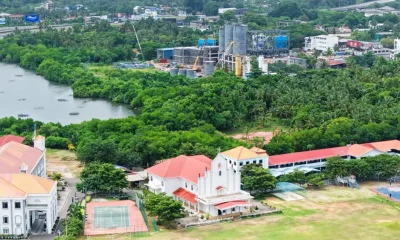
Protest against setting up of cement factory in highly populated area near BIA
-
 News6 days ago
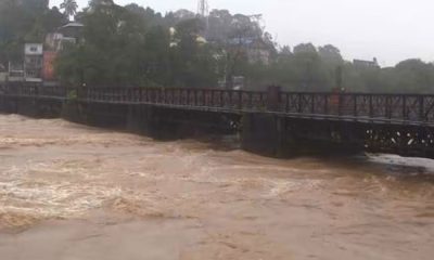
Mahaweli rises as heavy rain triggers flood, landslide fears
-

 Latest News7 days ago
Landslide Red Alerts issued to the districts of Kandy, Kegalle and Nuwara Eliya
-
 Midweek Review4 days ago
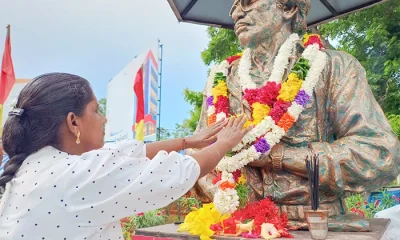
Thileepan’s fast unto death: An authentic narrative that many missed
-

 Editorial5 days ago
Trouble beginning in earnest
-
Editorial4 days ago
Big Bad Bills