Weather
Showers will occur at times in Western, North-western and Sabaragamuwa provinces and in Kandy, Matale, Nuwara-Eliya, Galle and Matara districts

Weather forecast issued at 05.30 a.m. on 21 September 2024 by the Department of Meteorology
Showers will occur at times in Western, North-western and Sabaragamuwa provinces and in Kandy, Matale, Nuwara-Eliya, Galle and Matara districts. Fairly heavy showers about 50 mm are likely at some places. Showers or thundershowers may occur at a few places in Eastern and Uva provinces during the evening or night.
Strong winds about (40-45)kmph can be expected at times over the western slopes of the central hills and in Northern, North-central and Southern provinces and in Matale and Puttalam districts.
Winds will be Westerly or South-westerly in direction in the sea areas and wind speed will be (30-40) kmph. Wind speed can increase up to 50 kmph at times in the sea areas off the coasts extending from Trincomalee to Kankasanthurai and from Puttalam to Matara via Colombo and Galle and up to 60 kmph at times in the sea areas off the coasts extending from Matara to Pottuvil via Hambantota and from Kankasanthurai to Puttalam via Mannar.
The sea areas off the coasts extending from Matara to Pottuvil via Hambantota and from Kankasanthurai to Puttalam via Mannar will be rough at times while the sea areas off the coasts extending from Trincomalee to Kankasanthurai and from Puttalam to Matara via Colombo and Galle will be fairly rough at times.
Strong gusty winds and very rough seas can be expected during thundershowers.
The general public is kindly requested to take adequate precautions to minimize damages caused by temporary localized strong winds and lightning during thundershowers.

WEATHER FORECAST FOR 04 MARCH 2026
Issued at 05.30 a.m. on 04 March 2026 by the Department of Meteorology
Mainly dry weather will prevail in most parts of the island.
Misty conditions can be expected at some places in the Western, Sabaragamuwa, Central, Southern, North-western and North-central provinces and in Jaffna district during the early hours of the morning.
WEATHER FORECAST FOR 03 MARCH 2026
Issued at 05.30 a.m. on 03 March 2026. by the Department of Meteorology
Mainly dry weather will prevail in most parts of the island.
Misty conditions can be expected at some places in the Western, Sabaragamuwa, Central, Southern and North-central provinces and in Vavuniya district during the early hours of the morning.
WEATHER FORECAST FOR 02 MARCH 2026
Issued at 05.30 a.m. on 02 March 2026. by the Department of Meteorology
Misty conditions can be expected at some places in the Western, Sabaragamuwa, Central, Southern and North-western provinces and in Anuradhapura and Vavuniya districts during the early hours of the morning.
Mainly dry weather will prevail in most parts of the island.

Free 14 day visa extension for visitors unable to depart Sri Lanka

US embassy in Dubai hit; Israel pounds Tehran, Beirut

Perera, Sugandika, Ranaweera take Sri Lanka to T20I series win over West Indies

Maldives Coast Guard Ship Huravee arrives in Colombo

New charges for son of Norway’s crown princess on trial for rape

US sends planes to evacuate nationals from Middle East as Iran conflict spreads

‘Dates have the highest sugar content to fight Coronavirus’

Sunday Island 27 December – Headlines

#SundayIsland 17th December – Headlines

Sunday Island – 28th March

Sunday Island Headlines – 21 March

Sunday Island – 21st February – Headlines
-

 Opinion5 days ago
Jamming and re-setting the world: What is the role of Donald Trump?
-

 Features5 days ago
An innocent bystander or a passive onlooker?
-

 Features2 days ago
Brilliant Navy officer no more
-

 Features6 days ago
Ratmalana Airport: The Truth, The Whole Truth, And Nothing But The Truth
-

 Opinion2 days ago
Sri Lanka – world’s worst facilities for cricket fans
-
 Business6 days ago
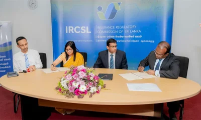
IRCSL transforms Sri Lanka’s insurance industry with first-ever Centralized Insurance Data Repository
-

 Business5 days ago
An efficacious strategy to boost exports of Sri Lanka in medium term
-

 Features3 days ago
Overseas visits to drum up foreign assistance for Sri Lanka