
Weather
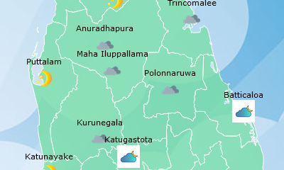
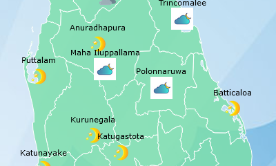
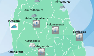
Showers in Western, Sabaragamuwa, Central, Southern, North-western and Northern provinces

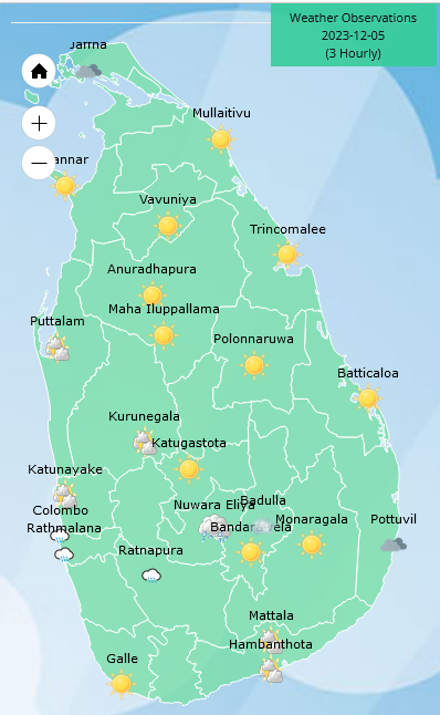
Weather forecast issued at 05.30 a.m.on 05 December 2023 by the Department of Meteorology
The Severe Cyclonic Storm “MICHAUNG” (PRONOUNCED AS “MIGJAUM”) over West-Central Bay of Bengal was located near latitude 14.5°N and longitude 80.3°E, at 2330hrs of 04 December, about 520km North of Jaffna. The system is likely to move northwards and cross South Andhra Pradesh coasts around 1130hrs today, December 05, 2023.
Misty Condition can be expected in Western, Sabaragamuwa, Southern Central and Uva provinces during the morning.
Several spells of showers can be expected in Western, Sabaragamuwa, Central, Southern, North-western and Northern provinces. Showers or thundershowers will occur at several places elsewhere after 01.00 p.m.
Winds will be South-westerly and wind speed will be (30-40) kmph in the sea areas around the island. Wind speed may increase up to (45-50) kmph in the sea areas off the coast extending from Chilaw to Trincomalee via Mannar and Kankasanthurai and from Hambanthota to Pottuvil.
The sea areas off the coast extending from Chilaw to Trincomalee via Mannar and Kankasanthurai and from Hambanthota to Pottuvil can be rough at times but temporarily strong gusty winds and very rough seas can be expected during thundershowers.
The general public is kindly requested to take adequate precautions to minimize damages caused by temporary localized strong winds and lightning during thundershowers.







Weather
Showers about 100mm will occur in the Western, Sabaragamuwa, Central and North-western provinces and in Galle and Matara Districts

WEATHER FORECAST FOR 22 SEPTEMBER 2026
Issued at 05.30 a.m. on 22 September 2026 by the Department of Meteorology
The low-pressure area that was prevailing over the sea area of the Bay of Bengal, to the northeast of the island, has now developed into a depression. It is expected to further develop into a deep depression within the next 24 hours.
Although this system will not have a direct impact on Sri
Lanka, the prevailing rainy conditions in the southwestern part of the island are expected to continue due to the wind flow towards the system.
Showers or thundershowers will occur at times in the Western, Sabaragamuwa, Central and North-western provinces and in Galle and Matara Districts. Heavy showers about 100 mm are likely at some places in the above areas.
Several spells of showers may occur in the North-central province and Mannar district. Showers or thundershowers will occur at several places in the Uva province and in Batticaloa and Ampara districts after 2.00 p.m.
Strong winds of about (40-50) kmph can be expected at times over Western slopes of the Central hills, the North-central and North-western provinces and in Trincomalee, Hambantota and Matale Districts.
The general public is kindly requested to take adequate precautions to minimize damage caused by temporary by
temporary localized strong winds and lightning during thundershowers.
Weather
Showers about 100 mm are likely at times in the Western, Sabaragamuwa and North-western provinces and in Galle, Matara, Kandy and Nuwara-Eliya Districts

WEATHER FORECAST FOR 21 SEPTEMBER 2026
Issued at 05.30 a.m. on 21 September 2026 by the Department of meteorology
The low-pressure area that has formed over the Andaman Sea region of the Bay of Bengal is expected to intensify further over the next few days.
Although this system will not have a direct impact on Sri Lanka, the prevailing rainy conditions in the southwestern part of the island are expected to continue due to the wind flow towards the system.
Showers or thundershowers will occur at times in the Western, Sabaragamuwa and North-western provinces and in Galle, Matara, Kandy and Nuwara-Eliya Districts. Heavy showers about 100 mm are likely at some places in the above areas.
Several spells of showers may occur in the North-central province and Mannar district. Showers or thundershowers will occur at several places in the Uva province and in Batticaloa and Ampara districts after 2.00 p.m.
Fairly strong winds of about (30-40) kmph can be expected at times over the Western slopes of the Central hills, the North-central and North-western provinces and in Trincomalee, Hambantota and Matale Districts.
The general public is kindly requested to take adequate precautions to minimize damage caused by temporary localized strong winds and lightning during thundershowers.
Latest News
Flood warning issued to the Divisional Secretariat Divisions of Ganga Ihala Korale, Udapalatha, Doluwa, Udunuwara, Yatinuwara, Gangawata Korale, Harispattuwa, and Pathadumbara

Due to heavy rainfall received in the upper catchment areas of the Mahaweli River over the past few hours, there is a risk of minor flooding in the low-lying areas surrounding the Mahaweli River within the Divisional Secretariat Divisions of Ganga Ihala Korale, Udapalatha, Doluwa, Udunuwara, Yatinuwara, Gangawata Korale, Harispattuwa, and Pathadumbara.Residents living in the above mentioned areas and motorists using roads passing through these areas are urged to exercise extreme caution and remain highly vigilant regarding the prevailing situation.
Furthermore, residents living in close proximity to the Mahaweli River in these areas are advised to remain highly alert to the situation and take all necessary precautions to protect themselves from any potential flooding.The relevant disaster management authorities are requested to take all necessary measures in response to this situation.

High Court convicts 14 over deadly Easter bombings

Mandhana, Shafali and Ghosh lead dominant India to Asian Games gold

Fatima Sana and Umm-e-Hani secure bronze for Pakistan in Asian Games

India bat first in Asian games womens cricket final

Showers about 100mm will occur in the Western, Sabaragamuwa, Central and North-western provinces and in Galle and Matara Districts

Govt. confident of 2/3 majority despite NPP split speculation

‘Dates have the highest sugar content to fight Coronavirus’

Sunday Island 27 December – Headlines

#SundayIsland 17th December – Headlines

Sunday Island – 28th March

Sunday Island Headlines – 21 March

Sunday Island – 21st February – Headlines
-

 News6 days ago
US embassy won’t comment on IGP’s probe into joint drug raid
-

 News5 days ago
Bid for Basil’s extradition nears final stage: Police
-

 News4 days ago
Shanakiyan urges urgent action over reported death sentence for Lankan in Saudi Arabia
-

 Business6 days ago
All-new Bolero MaXX unveiled in Sri Lanka
-

 News3 days ago
Namal Rajapaksa Buddhist gambit fails, bail denied
-

 Opinion6 days ago
A journalist who wrote across the divide
-

 Editorial7 days ago
More fuel price shocks shrouded in secrecy
-

 Sports7 days ago
MAS Holdings, official clothing sponsor of Sri Lanka team at Aichi–Nagoya 2026 Asian Games