Features
Revisiting ongoing Upper Elahera Canal project
By Neville Ladduwahetty
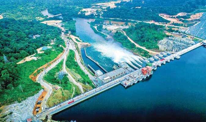
The Upper Elahera Canal (UEC) was conceived with the objective of transferring water from the Moragakanda Reservoir in the Central Province to existing reservoirs in the North Central Province and eventually to water deficit areas in the North via a 92-km canal that includes a 27.7-km tunnel. The UEC is designed to convey 974 MCM (Million Cubic Meters) of water annually. This design capacity is based on the premise that 772 MCM of water would be transferred north starting from Randenigala to Moragahakanda through a series of reservoirs and canals, first to Kalu Ganga and eventually to Moragahakanda.
Since the infrastructure needed to transfer 772 MCM from Randenigala has not commenced, and is not likely to become operational for well over a decade, the only water that would be available at Moragahakanda during the interim would be what is transferred from Bowatenna (496 MCM) and from its own catchment (344 MCM) making a total of 840 MCM. However, before any water could be conveyed to the North Central Province through the UEC, water has to be diverted to the Minneriya Yoda Ela (617 MCM) to irrigate lands served by Minneriya, Kaudulla, Kantalai and Giritale tanks. This leaves ONLY 223 MCM to be conveyed by the UEC to the North Central Province.
Although the UEC is being constructed to convey 974 MCM, ONLY 223 MCM of water would be available for transfer through the UEC to the North Central Province until water could be transferred from Randenigala. This means that ONLY 23 % of the capacity of the UEC would be utilised. Since this situation would prevail for well over a decade, serious attention should be given to evaluate how best to utilise the available 223 MCM to meet the demands of the North Central Province.
The data presented above is from an ADB Technical Assistance Consultant’s Report titled “Sri Lanka: Water Resources Development Investment Program” for the Ministry of Irrigation and Water Resource Management dated December 2014, Paragraph 21, p. 343, Project No. 47381.
WATER DEMANDS in the NORTH CENTRAL PROVINCE
According to the Executive Summary of the Environment Impact Assessment Report of December 2014 for the Ministry of Irrigation and Water Resources Management prepared by Mahaweli Consultancy Bureau (MCB), the UEC is to transfer water from Moragahakanda reservoir to Mannankattiya reservoir in the North Central Province where it divides into two branches; the Manankattiya-Eruwewa-Mahakandarawa and Huruluwewa. Improvements to existing water conveyance systems in each branch is an integral part of the UEC Project.
“The studies by the MCB show that 281 MCM is intended to be transferred at Manankattiya outlet with 155 MCM to Manankattiya-Eruwewa-Mahakandarawa and 126 MCM to Huruluwewa (MCB,2012 b). With these transfers, it is planned to increase the cropping intensity from around 1.2 to 1.8 (MCB, 2012a)” (Ibid).
The significance of the comment “increase the cropping intensity” means that 281 MCM is available for both seasons Maha and Yala. However, since these reservoirs would receive sufficient water from the North-East Monsoon at least for the Maha crop, the quantity of water needed for Yala could generously be assumed to be half of 281 MCM which is 140 MCM to be conveyed to the North Central Province via the UEC. This leaves a balance of 223 MCM less 140 MCM, which is 83 MCM, from which 70 MCM could be used as raw water for domestic needs. This means that practically all of the 223 MCM conveyed by the UEC would be needed to meet the demands in the North Central Province.
EXISTENTIAL REALTIES
In the absence of the needed infrastructure to transfer 772 MCM from Randenigala to Moragahakanda, the existential reality is that ONLY 223 MCM is available to meet the agricultural and domestic demands of the North Central Province. The other existential reality is that IF the infrastructure needed to transfer 772 MCM from Randenigala to Moragahakanda is in place and functioning, the UEC would be transferring its full design capacity of 974 MCM to the North Central and Northern Provinces.
THEREFORE, THE TRANSFER OF WATER VIA THE UEC PRESENTS TWO PHASES.
PHASE I: THE UEC TO TRANSFER ONLY 223 MCM TO THE NORTH CENTRAL PROVINCE UNTIL THE CONSTRUCTION OF THE INFRASTRUCTURE TO TRANSFER WATER FROM RANDENIGALA TO MORAGAHAKANDA IS COMPLETED. DURING THIS PHASE, SINCE 223 MCM MEETS ONLY THE DEMANDS OF THE NORTH CENTRAL PROVINCE, NO WATER WOULD BE AVAILABLE VIA THE UEC FOR THE NORTHERN PROVINCE. THEREFORE, THE NORTHERN PROVINCE WOULD HAVE TO DEVELOP INDEPENDENT INFRASTRUCTURE TO HARNESS THE NORTH-EAST MONSOONAL RAINS.
PHASE II: TO TRANSFER THE DESIGN CAPACITY OF 974 MCM TO THE NORTH CENTRAL AND NORTHERN PROVINCES, WHEN THE INFRASTRUCTURE NEEDED TO TRANSFER WATER FROM RANDENIGALA TO MORAGAHAKANDA IS COMPLETED. DURING THIS PHASE, 223 MCM OUT OF THE 974 MCM WOULD BE DIVERTED TO MEET THE DEMANDS OF THE NORTH CENTRAL PROVINCE WITH THE BALANCE OF 751 MCM BEING TRANSFERRED TO THE NORTHERN PROVINCE. CURRENTLY, THE NORTHERN PROVINCE IS NOT EQUIPPED WITH THE NEEDED INFRASTRUCTURE TO ACCOMMODATE 751 MCM OF WATER.
THUS, UNDER EITHER PHASE, ADDITIONAL INFRASTRUCTURE WOULD BE NEEDED IN THE NORTHERN PROVINCE; A FACT THAT HAS NOT BEING ADDRESSED HITHERTO.
MAKING HARD CHOICES
What is evident from either option is that infrastructure of one form or another is needed in the Northern Province, regardless of the option chosen. That being the case, the choice made would depend on cost and which option would make sense. Since the transfer of water from Randenigala would mostly be from the North-East Monsoon and since the same Monsoon brings rain water to the Northern Province, it makes absolutely no sense to transfer water from the South to the North. What would make far more sense instead, is to harness the Monsoonal rains that fall in the Northern Province as stated under Option I. Furthermore, since the UEC would be transferring only 223 MCM, the scale of the UEC that is being constructed should be considerably reduced and therefore less costly than what is being constructed. In addition, factoring in the savings that would arise by not investing in the infrastructure needed to transfer water from Randenigala to Moragahakanda, it would ensure further cost savings which, taken together would be considerable.
CONCLUSION
What is proposed earnestly and seriously, is that an appeal to the Ministry of Irrigation and Water Resources Management and to the Mahaweli Authority be made to rethink and abandon all Projects associated with the prospect of transferring water from Randenigala to Moragahakanda. The immediate consequence of accepting what is proposed would be to seriously scale down the scope of the Upper Elahera Canal that is currently being constructed, from its ability to transfer 974 MCM to 223 MCM, thus meeting the demands of the North Central Province in respect of its needs for agriculture and domestic raw water.
As for catering to the needs of the water deficit in the Northern Province, since fresh infrastructure is needed in the Northern Province under either of the two options addressed above, what is proposed herein is to construct the needed infrastructure to harness the North-East Monsoonal rains to meet its agricultural and domestic needs, instead of transferring water from Randenigala which incidentally, is from the same North-East Monsoon.
Attempts to promote and advance this concept on the basis of its multiple benefits by way of cost and prudence among those who are intimately associated with the ongoing Upper Elahera Canal Project, and those who should be held accountable, have failed. In this regard, those who have been promoting the concept cited above are indeed heartened by the comments the President Ranil Wickramasinghe made during a discussion with Tamil Parliamentarians representing the North and East. He referred to the need to include River for Jaffna (bringing fresh water to Jaffna Lagoon, and increasing the capacity of Iranamadu Tank), the Small Tanks renewable program…” (The Daily News, July 19, 2023).
According to the seminal work of S. Arumugam which contains a wealth of information relating to past and present Irrigation in his book “Water Resources of Ceylon”, Iranamadu Kulam (82,000 ac.ft) “was the first tank to be constructed by the Irrigation Department”. However, Mr. Arumugam also refers to several ancient tanks whose antiquities are not known, such as Akkarayan Kulam (17,000 ac ft); Kalmadu Kulam (9,150 ac. ft); Muthu Iyan Kaddu Kulam (41,000 ac. ft); Thannimurippu Kulam 15,000 ac. ft) assigned to King Aggabodhi [575 -608], Furthermore, what is remarkable is the fact that the cumulative capacity of ONLY these 4 ancient tanks match the capacity of Iranamadu Kulam, demonstrating that that the practice of harnessing North-East Monsoonal rains to irrigate the North was clearly an ancient irrigation practice.
Since restoring these 4 ancient Kulams alone would double the existing storage capacity in the Northern Province, the focus should be to develop these tanks and other small Kulams, as planned by the President. Therefore, it is imperative that the President directs the appropriate Ministries and related Departments to abandon the idea of transferring water from Randenigala, and revise the scope and scale of the Upper Elehera Canal to be in keeping with what makes sense.


Insights from global adaptation strategies
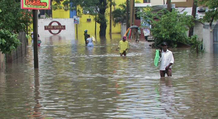
Sri Lanka has been heavily affected by floods, and extreme flooding is rapidly becoming one of the most disruptive climate hazards worldwide. The consequences extend far beyond damaged infrastructure and displaced communities. The food systems and supply networks are among the hardest hit. Floods disrupt food systems through multiple pathways. Croplands are submerged, livestock are lost, and soils become degraded due to erosion or sediment deposition. Infrastructural facilities like roads, bridges, retail shops, storage warehouses, and sales centres are damaged or rendered inaccessible. Without functioning food supply networks, even unaffected food-producing regions struggle to continue daily lives in such disasters. Poor households, particularly those dependent on farming or informal rural economies, face sharp food price increases and income loss, increasing vulnerability and food insecurity.
Many countries now recognie that traditional emergency responses alone are no longer enough. Instead, they are adopting a combination of short-term stabilisation measures and long-term strategies to strengthen food supply chains against recurrent floods. The most common immediate response is the provision of emergency food and cash assistance. Governments, the World Food Programme, and other humanitarian organisations often deliver food, ready-to-eat rations, livestock feed, and livelihood support to affected communities.
Alongside these immediate measures, some nations are implementing long-term strategic actions. These include technology- and data-driven approaches to improve flood preparedness. Early warning systems, using satellite data, hydrological models, and advanced weather forecasting, allow farmers and supply chain operators to prepare for potential disruptions. Digital platforms provide market intelligence, logistics updates, and risk notifications to producers, wholesalers, and transporters. This article highlights examples of such strategies from countries that experience frequent flooding.
China: Grain Reserves and Strategic Preparedness
China maintains a large strategic grain reserve system for rice, wheat, and maize; managed by NFSRA-National Food and Strategic Reserves Administration and Sinograin (China Grain Reserves Corporation (Sinograin Group), funded by the Chinese government, that underpins national food security and enables macro-control of markets during supply shocks. Moreover, improvements in supply chain digitization and hydrological monitoring, the country has strengthened its ability to maintain stable food availability during extreme weather events.
Bangladesh: Turning Vulnerability into Resilience
In recent years, Bangladesh has stood out as one of the world’s most flood-exposed countries, yet it has successfully turned vulnerability into adaptive resilience. Floating agriculture, flood-tolerant rice varieties, and community-run grain reserves now help stabilise food supplies when farmland is submerged. Investments in early-warning systems and river-basin management have further reduced crop losses and protected rural livelihoods.
Netherlands, Japan: High-Tech Models of Flood Resilience
The Netherlands offers a highly technical model. After catastrophic flooding in 1953, the country completely redesigned its water governance approach. Farmland is protected behind sea barriers, rivers are carefully controlled, and land-use zoning is adaptive. Vertical farming and climate-controlled greenhouses ensure year-round food production, even during extreme events. Japan provides another example of diversified flood resilience. Following repeated typhoon-induced floods, the country shifted toward protected agriculture, insurance-backed farming, and automated logistics systems. Cold storage networks and digital supply tracking ensure that food continues to reach consumers, even when roads are cut off. While these strategies require significant capital and investment, their gradual implementation provides substantial long-term benefits.
Pakistan, Thailand, Indonesia, and Vietnam: Reform in Response to Recurrent Floods
In contrast, Pakistan and Thailand illustrate both the consequences of climate vulnerability and the benefits of proactive reform. The 2022 floods in Pakistan submerged about one-third of the country, destroying crops and disrupting trade networks. In response, the country has placed greater emphasis on climate-resilient farming, water governance reforms, and satellite-based crop monitoring. Pakistan as well as India is promoting crop diversification and adjusting planting schedules to help farmers avoid the peak monsoon flood periods.
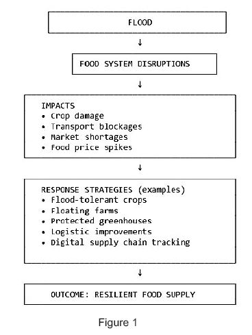
Thailand has invested in flood zoning and improved farm infrastructure that keep markets supplied even during severe flooding. Meanwhile, Indonesia and Vietnam are actively advancing flood-adapted land-use planning and climate-resilient agriculture. For instance, In Vietnam’s Mekong Delta, pilot projects integrate flood-risk mapping, adaptive cropping strategies, and ecosystem-based approaches to reduce vulnerability in agricultural and distribution areas. In Indonesia, government-supported initiatives and regional projects are strengthening flood-risk-informed spatial planning, adaptive farming practices, and community-based water management to improve resilience in flood-prone regions. (See Figure 1)
 The Global Lesson: Resilience Requires Early Investment
The global evidence is clear: countries that invest early in climate-adaptive agriculture and resilient logistics are better able to feed their populations, even during extreme floods. Building a resilient future depends not only on how we grow food but also on how we protect, store, and transport it. Strengthening infrastructure is therefore central to stabilising food supply chains while maintaining food quality, even during prolonged disruptions. Resilient storage systems, regional grain reserves, efficient cold chains, improved farming infrastructure, and digital supply mapping help reduce panic buying, food waste, and price shocks after floods, while ensuring that production capacity remains secure.
Persistent Challenges
However, despite these advances, many flood-exposed countries still face significant challenges. Resources are often insufficient to upgrade infrastructure or support vulnerable rural populations. Institutional coordination across the agriculture, disaster management, transport, and environmental sectors remains weak. Moreover, the frequency and scale of climate-driven floods are exceeding the design limits of older disaster-planning frameworks. As a result, the gap between exposure and resilience continues to widen. These challenges are highly relevant to Sri Lanka as well and require deliberate, gradual efforts to phase them out.
The Role of International Trade and global markets
When domestic production falls in such situations, international trade serves as an important buffer. When domestic production is temporarily reduced, imports and regional trade flows can help stabilise food availability. Such examples are available from other countries. For instance, In October 2024, floods in Bangladesh reportedly destroyed about 1.1 million tonnes of rice. In response, the government moved to import large volumes of rice and allowed accelerated or private-sector imports of rice to stabilize supply and curb food price inflation. This demonstrates how, when domestic production fails, international trade/livestock/food imports (from trade partners) acted as a crucial buffer to ensure availability of staple food for the population. However, this approach relies on well-functioning global markets, strong diplomatic relationships, and adequate foreign exchange, making it less reliable for economically fragile nations. For example, importing frozen vegetables to Sri Lanka from other countries can help address supply shortages, but considerations such as affordability, proper storage and selling mechanisms, cooking guidance, and nutritional benefits are essential, especially when these foods are not widely familiar to local populations.
Marketing and Distribution Strategies during Floods
Ensuring that food reaches consumers during floods requires innovative marketing and distribution strategies that address both supply- and demand-side challenges. Short-term interventions often include direct cash or food transfers, mobile markets, and temporary distribution centres in areas where conventional marketplaces become inaccessible. Price stabilisation measures, such as temporary caps or subsidies on staple foods, help prevent sharp inflation and protect vulnerable households. Awareness campaigns also play a role by educating consumers on safe storage, cooking methods, and the nutritional value of unfamiliar imported items, helping sustain effective demand.
Some countries have integrated technology to support these efforts; in this regard, adaptive supply chain strategies are increasingly used. Digital platforms provide farmers, wholesalers, and retailers with real-time market information, logistics updates, and flood-risk alerts, enabling them to reroute deliveries or adjust production schedules. Diversified delivery routes, using alternative roads, river transport, drones, or mobile cold-storage units, have proven essential for maintaining the flow of perishable goods such as vegetables, dairy, and frozen products. A notable example is Japan, where automated logistics systems and advanced cold-storage networks help keep supermarkets stocked even during severe typhoon-induced flooding.
The Importance of Research, Coordination, and Long-Term Commitment
Global experience also shows that research and development, strong institutional coordination, and sustained national commitment are fundamental pillars of flood-resilient food systems. Countries that have successfully reduced the impacts of recurrent floods consistently invest in agricultural innovation, cross-sector collaboration, and long-term planning.
Awareness Leads to Preparedness
As the summary, global evidence shows that countries that act early, plan strategically, and invest in resilience can protect both people and food systems. As Sri Lanka considers long-term strategies for food security under climate change, learning from flood-affected nations can help guide policy, planning, and public understanding. Awareness is the first step which preparedness must follow. These international experiences offer valuable lessons on how to protect food systems through proactive planning and integrated actions.
(Premaratne (BSc, MPhil, LLB) isSenior Lecturer in Agricultural Economics Department of Agricultural Systems, Faculty of Agriculture, Rajarata University. Views are personal.)
Key References·
Cabinet Secretariat, Government of Japan, 2021. Fundamental Plan for National Resilience – Food, Agriculture, Forestry and Fisheries / Logistics & Food Supply Chains. Tokyo: Cabinet Secretariat.
· Delta Programme Commissioner, 2022. Delta Programme 2023 (English – Print Version). The Hague: Netherlands Delta Programme.
· Hasanuddin University, 2025. ‘Sustainable resilience in flood-prone rice farming: adaptive strategies and risk-sharing around Tempe Lake, Indonesia’, Sustainability. Available at: https://www.mdpi.com/2071-1050/17/6/2456 [Accessed 3 December 2025].
· Mekong Urban Flood Resilience and Drainage Programme (TUEWAS), 2019–2021. Integrated urban flood and drainage planning for Mekong cities. TUEWAS / MRC initiative.
· Ministry of Agriculture and Rural Affairs, People’s Republic of China, 2025. ‘China’s summer grain procurement surpasses 50 mln tonnes’, English Ministry website, 4 July.
· National Food and Strategic Reserves Administration (China) 2024, ‘China purchases over 400 mln tonnes of grain in 2023’, GOV.cn, 9 January. Available at: https://english.www.gov.cn/archive/statistics/202401/09/content_WS659d1020c6d0868f4e8e2e46.html
· Pakistan: 2022 Floods Response Plan, 2022. United Nations / Government of Pakistan, UN Digital Library.
· Shigemitsu, M. & Gray, E., 2021. ‘Building the resilience of Japan’s agricultural sector to typhoons and heavy rain’, OECD Food, Agriculture and Fisheries Papers, No. 159. Paris: OECD Publishing.
· UNDP & GCF, 2023. Enhancing Climate Resilience in Thailand through Effective Water Management and Sustainable Agriculture (E WMSA): Project Factsheet. UNDP, Bangkok.
· United Nations Development Programme (UNDP), 2025. ‘Rice Bank revives hope in flood hit hill tracts, Bangladesh’, UNDP, 19 June.
· World Bank, 2022. ‘Bangladesh: World Bank supports food security and higher incomes of farmers vulnerable to climate change’, World Bank press release, 15 March.

Weather forecasts are useful. People attentively listen to them but complain that they go wrong or are not taken seriously. Forecasts today are more probabilistically reliable than decades ago. The advancement of atmospheric science, satellite imaging, radar maps and instantly updated databases has improved the art of predicting weather.
Yet can we predict weather patterns precisely? A branch of mathematics known as chaos theory says that weather can never be foretold with certainty.
The classical mechanics of Issac Newton governing the motion of all forms of matter, solid, liquid or gaseous, is a deterministic theory. If the initial conditions are known, the behaviour of the system at later instants of time can be precisely predicted. Based on this theory, occurrences of solar eclipses a century later have been predicted to an accuracy of minutes and seconds.
The thinking that the mechanical behaviour of systems in nature could always be accurately predicted based on their state at a previous instant of time was shaken by the work of the genius French Mathematician Henri Poincare (1864- 1902).
Eclipses are predicted with pinpoint accuracy based on analysis of a two-body system (Earth- Moon) governed by Newton’s laws. Poincare found that the equivalent problem of three astronomical bodies cannot be solved exactly – sometimes even the slightest variation of an initial condition yields a drastically different solution.
A profound conclusion was that the behaviour of physical systems governed by deterministic laws does not always allow practically meaningful predictions because even a minute unaccountable change of parameters leads to completely different results.
Until recent times, physicists overlooked Poincare’s work and continued to believe that the determinism of the laws of classical physics would allow them to analyse complex problems and derive future happenings, provided necessary computations are facilitated. When computers became available, the meteorologists conducted simulations aiming for accurate weather forecasting. The American mathematician Edward Lorenz, who turned into a reputed meteorologist, carried out such studies in the early 1960s, arrived at an unexpected result. His equations describing atmospheric dynamics demonstrated a strange behaviour. He found that even a minute change (even one part in a million) in initial parameters leads to a completely different weather pattern in the atmosphere. Lorenz announced his finding saying, A flap of a butterfly wing in one corner of the world could cause a cyclone in a far distant location weeks later! Lorenz’s work opened the way for the development branch of mathematics referred to as chaos theory – an expansion of the idea first disclosed by Henri Poincare.
We understand the dynamics of a cyclone as a giant whirlpool in the atmosphere, how it evolves and the conditions favourable for their origination. They are created as unpredictable thermodynamically favourable relaxation of instabilities in the atmosphere. The fundamental limitations dictated by chaos theory forbid accurate forecasting of the time and point of its appearance and the intensity. Once a cyclone forms, it can be tracked and the path of movement can be grossly ascertained by frequent observations. However, absolutely certain predictions are impossible.
A peculiarity of weather is that the chaotic nature of atmospheric dynamics does not permit ‘long – term’ forecasting with a high degree of certainty. The ‘long-term’ in this context, depending on situation, could be hours, days or weeks. Nonetheless, weather forecasts are invaluable for preparedness and avoiding unlikely, unfortunate events that might befall. A massive reaction to every unlikely event envisaged is also not warranted. Such an attitude leads to social chaos. The society far more complex than weather is heavily susceptible to chaotic phenomena.
by Prof. Kirthi Tennakone (ktenna@yahoo.co.uk)
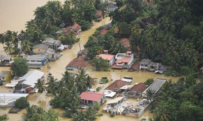
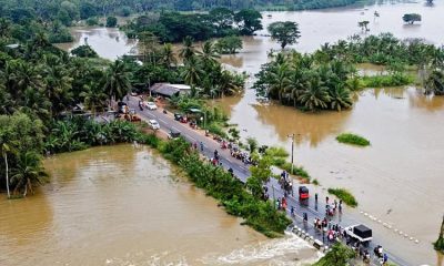
The water came quietly at first, a steady rise along the riverbanks, familiar to communities who have lived beside Sri Lanka’s great waterways for generations. But within hours, these same rivers had swollen into raging, unpredictable forces. The Kelani Ganga overflowed. The Nilwala broke its margins. The Bentara, Kalu, and Mahaweli formed churning, chocolate-brown channels cutting through thousands of homes.
When the floods finally began to recede, villagers emerged to assess the damage, only to be confronted by another challenge: crocodiles. From Panadura’s back lanes to the suburbs of Colombo, and from the lagoons around Kalutara to the paddy fields of the dry zone, reports poured in of crocodiles resting on bunds, climbing over fences, or drifting silently into garden wells.
For many, these encounters were terrifying. But to Sri Lanka’s top herpetologists, the message was clear: this is what happens when climate extremes collide with shrinking habitats.
“Crocodiles are not invading us … we are invading floodplains”
Sri Lanka’s foremost crocodile expert, Dr. Anslem de Silva, Regional Chairman for South Asia and Iran of the IUCN/SSC Crocodile Specialist Group, has been studying crocodiles for over half a century. His warning is blunt.
“When rivers turn into violent torrents, crocodiles simply seek safety,” he says. “They avoid fast-moving water the same way humans do. During floods, they climb onto land or move into calm backwaters. People must understand this behaviour is natural, not aggressive.”
In the past week alone, Saltwater crocodiles have been sighted entering the Wellawatte Canal, drifting into the Panadura estuary, and appearing unexpectedly along Bolgoda Lake.
“Saltwater crocodiles often get washed out to sea during big floods,” Dr. de Silva explains. “Once the current weakens, they re-enter through the nearest lagoon or canal system. With rapid urbanisation along these waterways, these interactions are now far more visible.”
-
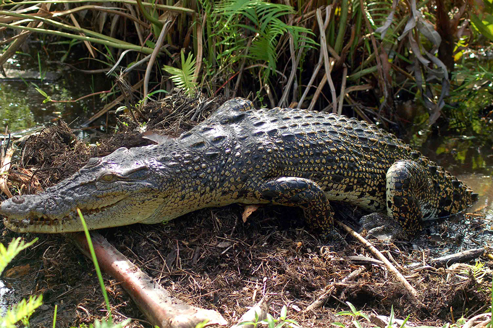
- An adult Salt Water Crocodile (Crocodylus porosus) (Photo -Madura de Silva)
-
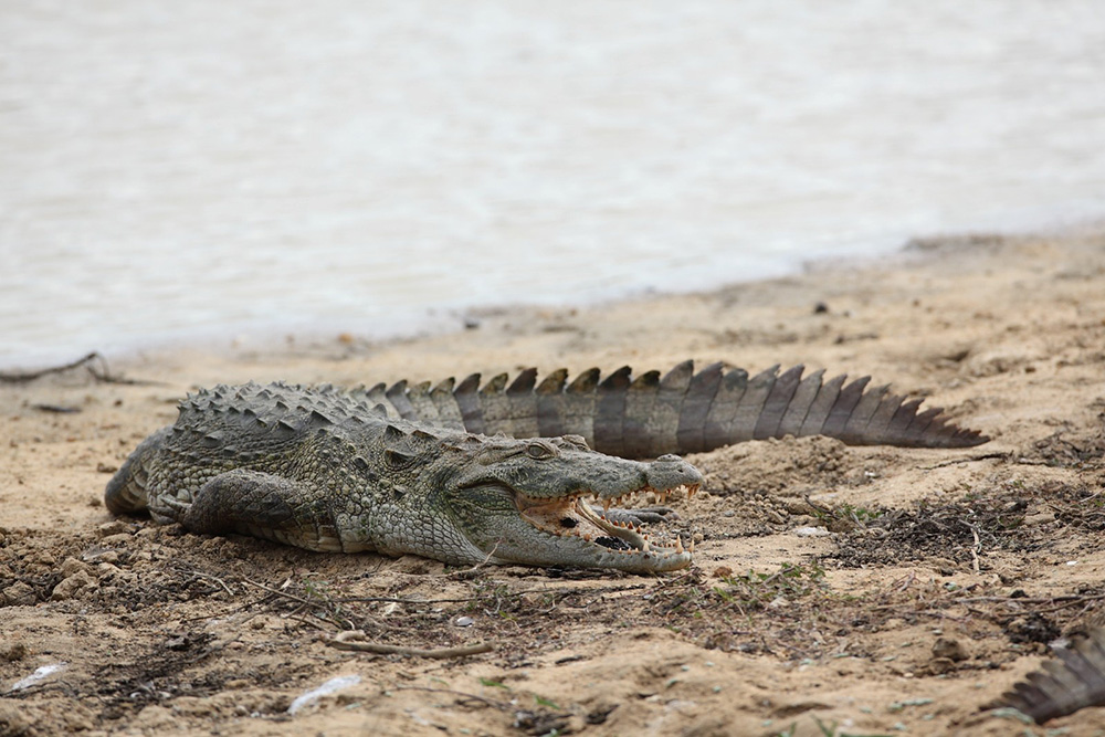
- Adult Mugger (Crocodylus plaustris) Photo -Laxhman Nadaraja
-

- A Warning sign board
-

- A Mugger holding a a large Russell ’s viper (Photo- R. M. Gunasinghe)
-

- Anslem de Silva
-
- Suranjan Karunarathna
This clash between wildlife instinct and human expansion forms the backdrop of a crisis now unfolding across the island.
A conflict centuries old—now reshaped by climate change
Sri Lanka’s relationship with crocodiles is older than most of its kingdoms. The Cūḷavaṃsa describes armies halted by “flesh-eating crocodiles.” Ancient medical texts explain crocodile bite treatments. Fishermen and farmers around the Nilwala, Walawe, Maduganga, Batticaloa Lagoon, and Kalu Ganga have long accepted kimbula as part of their environment.
But the modern conflict has intensified dramatically.
A comprehensive countrywide survey by Dr. de Silva recorded 150 human–crocodile attacks, with 50 fatal, between 2008 and 2010. Over 52 percent occurred when people were bathing, and 83 percent of victims were men engaged in routine activities—washing, fishing, or walking along shallow margins.
Researchers consistently emphasise: most attacks happen not because crocodiles are unpredictable, but because humans underestimate them.
Yet this year’s flooding has magnified risks in new ways.
“Floods change everything” — Dr. Nimal D. Rathnayake
Herpetologist Dr. Nimal Rathnayake says the recent deluge cannot be understood in isolation.
“Floodwaters temporarily expand the crocodile’s world,” he says. “Areas people consider safe—paddy boundaries, footpaths, canal edges, abandoned land—suddenly become waterways.”
Once the water retreats, displaced crocodiles may end up in surprising places.
“We’ve documented crocodiles stranded in garden wells, drainage channels, unused culverts and even construction pits. These are not animals trying to attack. They are animals trying to survive.”
According to him, the real crisis is not the crocodile—it is the loss of wetlands, the destruction of natural river buffers, and the pollution of river systems.
“When you fill a marsh, block a canal, or replace vegetation with concrete, you force wildlife into narrower corridors. During floods, these become conflict hotspots.”

Arm attacked by a crocodile (Photo – Anslem de Silva)

The leg is the part of the body most often targeted. (Photo – Anslem de Silva)
Past research by the Crocodile Specialist Group shows that more than 300 crocodiles have been killed in retaliation or for meat over the past decade. Such killings spike after major floods, when fear and misunderstanding are highest.
“Not monsters—ecosystem engineers” — Suranjan Karunaratne
On social media, flood-displaced crocodiles often go viral as “rogue beasts.” But conservationist Suranjan Karunaratne, also of the IUCN/SSC Crocodile Specialist Group, says such narratives are misleading.
“Crocodiles are apex predators shaped by millions of years of evolution,” he says. “They are shy, intelligent animals. The problem is predictable human behaviour.”
In countless attack investigations, Karunaratne and colleagues found a repeated pattern: the Three Sames—the same place, the same time, the same activity.
“People use the same bathing spot every single day. Crocodiles watch, learn, and plan. They hunt with extraordinary patience. When an attack occurs, it’s rarely random. It is the culmination of observation.”
He stresses that crocodiles are indispensable to healthy wetlands. They: control destructive catfish populations, recycle nutrients, clean carcasses and diseased fish, maintain biodiversity, create drought refuges through burrows used by amphibians and reptiles.
“Removing crocodiles destroys an entire chain of ecological services. They are not expendable.”
Karunaratne notes that after the civil conflict, Mugger populations in the north rebounded—proof that crocodiles recover when given space, solitude, and habitat.

Nimal D. Rathnayake
Floods expose a neglected truth: CEEs save lives—if maintained In high-risk communities, Crocodile Exclusion Enclosures (CEEs) are often the only physical barrier between people and crocodiles. Built along riverbanks or tanks, these enclosures allow families to bathe, wash, and collect water safely.
Yet Dr. de Silva recounts a tragic incident along the Nilwala River where a girl was killed inside a poorly maintained enclosure. A rusted iron panel had created a hole just large enough for a crocodile to enter.
“CEEs are a life-saving intervention,” he says. “But they must be maintained. A neglected enclosure is worse than none at all.”
Despite their proven effectiveness, many CEEs remain abandoned, broken or unused.
Climate change is reshaping crocodile behaviour—and ours
Sri Lanka’s floods are no longer “cycles” as described in folklore. They are increasingly intense, unpredictable and climate-driven. The warming atmosphere delivers heavier rainfall in short bursts. Deforested hillsides and filled wetlands cannot absorb it.
Rivers swell rapidly and empty violently.
Crocodiles respond as they have always done: by moving to calmer water, by climbing onto land, by using drainage channels, by shifting between lagoons and canals, by following the shape of the water.
But human expansion has filled, blocked, or polluted these escape routes.
What once were crocodile flood refuges—marshes, mangroves, oxbow wetlands and abandoned river channels—are now housing schemes, fisheries, roads, and dumpsites.
Garbage, sand mining and invasive species worsen the crisis
The research contained in the uploaded reports paints a grim but accurate picture. Crocodiles are increasingly seen around garbage dumps, where invasive plants and waste accumulate. Polluted water attracts fish, which in turn draw crocodiles.
Excessive sand mining in river mouths and salinity intrusion expose crocodile nesting habitats. In some areas, agricultural chemicals contaminate wetlands beyond their natural capacity to recover.
In Borupana Ela, a short study found 29 Saltwater crocodiles killed in fishing gear within just 37 days.
Such numbers suggest a structural crisis—not a series of accidents.
Unplanned translocations: a dangerous human mistake
For years, local authorities attempted to reduce conflict by capturing crocodiles and releasing them elsewhere. Experts say this was misguided.
“Most Saltwater crocodiles have homing instincts,” explains Karunaratne. “Australian studies show many return to their original site—even if released dozens of kilometres away.”
Over the past decade, at least 26 Saltwater crocodiles have been released into inland freshwater bodies—home to the Mugger crocodile. This disrupts natural distribution, increases competition, and creates new conflict zones.
Living with crocodiles: a national strategy long overdue
All three experts—Dr. de Silva, Dr. Rathnayake and Karunaratne—agree that Sri Lanka urgently needs a coordinated, national-level mitigation plan.
* Protect natural buffers
Replant mangroves, restore riverine forests, enforce river margin laws.
* Maintain CEEs
They must be inspected, repaired and used regularly.
* Public education
Villagers should learn crocodile behaviour just as they learn about monsoons and tides.
* End harmful translocations
Let crocodiles remain in their natural ranges.
* Improve waste management
Dumps attract crocodiles and invasive species.
* Incentivise community monitoring
Trained local volunteers can track sightings and alert authorities early.
* Integrate crocodile safety into disaster management
Flood briefings should include alerts on reptile movement.
“The floods will come again. Our response must change.”
As the island cleans up and rebuilds, the deeper lesson lies beneath the brown floodwaters. Crocodiles are not new to Sri Lanka—but the conditions we are creating are.
Rivers once buffered by mangroves now rush through concrete channels. Tanks once supporting Mugger populations are choked with invasive plants. Wetlands once absorbing floodwaters are now levelled for construction.
Crocodiles move because the water moves. And the water moves differently today.
Dr. Rathnayake puts it simply:”We cannot treat every flooded crocodile as a threat to be eliminated. These animals are displaced, stressed, and trying to survive.”
Dr. de Silva adds:”Saving humans and saving crocodiles are not competing goals. Both depend on understanding behaviour—ours and theirs.”
And in a closing reflection, Suranjan Karunaratne says:”Crocodiles have survived 250 million years, outliving dinosaurs. Whether they survive the next 50 years in Sri Lanka depends entirely on us.”
For now, as the waters recede and the scars of the floods remain, Sri Lanka faces a choice: coexist with the ancient guardians of its waterways, or push them into extinction through fear, misunderstanding and neglect.
By Ifham Nizam

Ireland among countries boycotting Eurovision after Israel allowed to compete

Putin says Russia will take Donbas by force or Ukraine’s troops will withdraw

486 dead, 341 missing, 171,778 displaced as at 0600hrs today [05]

Showers above 75 mm are likely at some places in the Western and Sabaragamuwa Provinces and in Galle and Matara districts

Media slams govt.’s bid to use Emergency to silence critics

Cardinal calls for compassionate Christmas amid crisis

‘Dates have the highest sugar content to fight Coronavirus’

Sunday Island 27 December – Headlines

#SundayIsland 17th December – Headlines

Sunday Island – 28th March

Sunday Island Headlines – 21 March

Sunday Island – 21st February – Headlines
-
 News5 days ago
Weather disasters: Sri Lanka flooded by policy blunders, weak enforcement and environmental crime – Climate Expert
-
 Latest News6 days ago
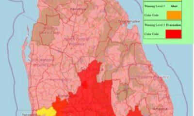
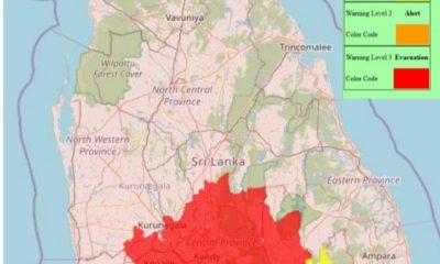
Level I landslide RED warnings issued to the districts of Badulla, Colombo, Gampaha, Kalutara, Kandy, Kegalle, Kurnegala, Natale, Monaragala, Nuwara Eliya and Ratnapura
-

 Latest News6 days ago
INS VIKRANT deploys helicopters for disaster relief operations
-
News2 days ago
Lunuwila tragedy not caused by those videoing Bell 212: SLAF
-
 Latest News6 days ago
Department of Irrigation issues Critical flood warning to the Kelani river basin
-
 Latest News3 days ago
Level III landslide early warnings issued to the districts of Badulla, Kandy, Kegalle, Kurunegala, Matale and Nuwara-Eliya
-
 News6 days ago
Country reels under worst weather in living memory
-

 Editorial6 days ago
Needed: Action not rhetoric