
Weather
Very heavy showers above 150mm are likely at some places in Western and Sabaragamuwa provinces and in Galle and Matara districts.


Weather forecast issued at 05.30 a.m. on 11 October 2024 by the Department of Meteorology
The prevailing showery condition is expected to continue further in the south-western part of the Island, due to the atmospheric disturbance in the vicinity of Sri Lanka.
Showers or thundershowers will occur at times in Western, Sabaragamuwa, Southern, North-western and Central provinces. Very heavy showers above 150mm are likely at some places in Western and Sabaragamuwa provinces and in Galle and Matara districts. Showers or thundershowers will occur elsewhere at several places in the island during the evening or nigh and fairly heavy showers above 75mm are likely at some places.
Strong winds about (40-50)kmph can be expected at times over the Western, Sabaragamuwa, Southern, North-western and Central provinces.
Winds will be Westerly to south-westerly in the sea areas off the coasts extending from Mannar to Pottuvil via Colombo and Galle. Wind speed will be (30-40) kmph and can be increase up to (55-65) kmph at times.
Winds will be southwesterly or variable in direction and wind speed will be (25-35) kmph in the other sea areas around the island
The sea areas off the coasts extending from Mannar to Hambantota via Colombo and Galle can be rough at times while other sea areas around the island can be slight to moderate.
The wave height (about 2.5–3.0 m) (this is not for land area) may increase in the sea areas off the coast extending from Colombo to Hambantota via Galle and Matara. Strong gusty winds and very rough seas can be expected during thundershowers.
The general public is kindly requested to take adequate precautions to minimize damages caused by temporary localized strong winds and lightning during thundershowers.


WEATHER FORECAST FOR 10 OCTOBER 2026
Issued at 05.30 a.m. on 10 October 2026 by rhe Department of Meteorology
Misty conditions can be expected at some places in the Western, Sabaragamuwa, Central and Uva provinces during the early hours of the morning.
Showers or thundershowers will occur in most parts of the island after 1.00 p.m.
Fairly heavy showers about 75 mm are likely at some places in the Western, Sabaragamuwa, Central, Uva and North-Western provinces and in Galle, Matara, Anuradhapura and Mannar districts.
The general public is kindly requested to take adequate precautions to minimize damage caused by temporary localized strong winds and lightning during thundershowers.
WEATHER FORECAST FOR 09 OCTOBER 2026
Issued at 05.30 a.m. on 09 October 2026 by the Department of Meteorology
Misty conditions can be expected at some places in the Western, Sabaragamuwa, Central and Uva provinces and in Galle and Matara districts during the early hours of the morning.
Showers or thundershowers will occur in most part of the island after 1.00 p.m.
Fairly heavy showers above 75 mm are likely at some places in the Western, Sabaragamuwa, Central, Uva, North-Western and Southern provinces and in Anuradhapura and Mannar districts.
The general public is kindly requested to take adequate precautions to minimize damage caused by temporary localized strong winds and lightning during thundershowers.
Latest News
Showers above 100 mm are likely at some places in the Western, Sabaragamuwa, Central, Uva and Southern provinces and in Anuradhapura district
WEATHER FORECAST FOR 08 OCTOBER 2026
Issued at 05.30 a.m. on 08 October 2026 by the Department of Meteorology
Misty conditions can be expected at some places in the Western, Sabaragamuwa, Central and Uva provinces and in Galle and Matara districts during the early hours of the morning.
Showers or thundershowers will occur in the most part of the island after 1.00 p.m. Heavy showers above 100 mm are likely at some places in Western, Sabaragamuwa, Central, Uva and Southern provinces and in Anuradhapura district.
The general public is kindly requested to take adequate precautions to minimize damage caused by temporary localized strong winds and lightning during thundershowers.

Sri Lanka ITEC Alumni Association formally launched

Measures underway to protect Diyagama Forest as a Reserve — Deputy Minister of Environment

Showers or thundershowers will occur in most parts of the island after 1.00 p.m.

NPP govt. reminded of its responsibilities as US warship leaves Colombo

CERT: Beware of foreign Uni. scams on social media

Shiranthi receives treatment at National Eye Hospital

‘Dates have the highest sugar content to fight Coronavirus’

Sunday Island 27 December – Headlines

#SundayIsland 17th December – Headlines

Sunday Island – 28th March

Sunday Island Headlines – 21 March

Sunday Island – 21st February – Headlines
-

 News5 days ago
Geneva takes up Sallay’s case and govt. ignores opportunity to answer accusations
-

 Features6 days ago
The first woman in the foreign service or Ceylon Overseas Service it was then called
-

 News6 days ago
Nearly 20 Iranian tankers stranded off Lanka amid US sanctions
-
 Features4 days ago
Preventing grievances from becoming communal
-

 Sports2 days ago
Nissanka absence opens door for Sri Lanka’s young guns
-
 Features5 days ago
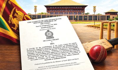
Sri Lanka Cricket Bill: Governance reform is not yet a cricket strategy
-

 News3 days ago
Gnansara Thera to be assigned to prison printing section: Officials
-

 News6 days ago
Lanka enters new phase of prosecutions as hurdles clear