
Weather
Heavy showers above 100mm are likely at some places in Western and Sabaragamuwa provinces and in Galle and Matara districts


Weather forecast issued at 05.30 a.m. on 10 October 2024 by the Department of Meteorology
The showery condition is expected to enhance to some extent in the south-western part of the Island in the next few days starting from today (10th), due to the development of atmospheric disturbance in the vicinity of Sri Lanka.
Showers or thundershowers will occur at times in the Northern, North-western, Western, Sabaragamuwa and Southern provinces. Heavy showers above 100mm are likely at some places in Western and Sabaragamuwa provinces and in Galle and Matara districts while showers or thundershowers will occur elsewhere at several places in the island during the evening or night.Fairly heavy showers above 75mm are likely at some places.
Winds will be Westerly to south-westerly in the sea areas off the coasts extending from Mannar to Hambantota via Colombo and Galle. Wind speed will be (30-40) kmph and can be increase up to (50-60) kmph at times. Winds will be variable in direction and wind speed will be (25-35) kmph in the other sea areas around the island.
The sea areas off the coasts extending from Mannar to Hambantota via Colombo and Galle can be fairly rough at times and other sea areas around the island can be slight to moderate. Strong gusty winds and very rough seas can be expected during thundershowers.
The general public is kindly requested to take adequate precautions to minimize damages caused by temporary localized strong winds and lightning during thundershowers.

Weather
Showers in the Western, Southern, Central, Sabaragamuwa, North-Western and Northern provinces and in the Anuradhapura District

WEATHER FORECAST FOR 16 OCTOBER 2026
Issued at 05.30 a.m. on 16 October 2026 by the Department of Meteorokogy
Cloudy sky will prevail over most parts of the Island.
Misty conditions can be expected at some places in the Sabaragamuwa, Central and Uva provinces during the early hours of the morning.
Showers or thundershowers will occur at times in the Western, Southern, Central, Sabaragamuwa, North-Western and Northern provinces and in the Anuradhapura District. Showers or thundershowers will occur at other parts of the island after 1.00 p.m.
Heavy showers above 100mm are likely at some places in the Northern, Western and North-western provinces and in Galle, Matara, Polonnaruwa and Trincomalee districts.
The general public is kindly requested to take adequate precautions to minimize damage caused by temporary localized strong winds and lightning during thundershowers.
WEATHER FORECAST FOR 15 OCTOBER 2026
Issued at 05.30 a.m. on 15 October 2026 by the Department of Meteorology
Misty conditions can be expected at some places in the Sabaragamuwa, Central and Uva provinces during the early hours of the morning.
Showers or thundershowers will occur at most parts of the island after 1.00 p.m. Heavy showers above 75 mm are likely at some places in the Sabaragamuwa, Central and North-central provinces and in Trincomalee and Kurunegala districts.
A Few shower may occur in the coastal areas of the Western Province and in the Galle and Matara districts during the morning.
The general public is kindly requested to take adequate precautions to minimize damage caused by temporary localized strong winds and lightning during thundershowers.
Latest News
Heavy showers above 100 mm are likely at some places in the Western, Sabaragamuwa, Southern, Central, and North-western provinces and in Anuradhapura district.
WEATHER FORECAST FOR 14 OCTOBER 2026
Issued at 05.30 a.m. on 14 October 2026 by the Department of Meteorology
Due to a low-level atmospheric disturbance persisting in the Bay of Bengal near Sri Lanka, cloudy skies and increased rainfall are expected to continue over the island.
Misty conditions can be expected at some places in the Sabaragamuwa, Central and Uva provinces during the early hours of the morning.
Showers or thundershowers will occur at times in the Northern, Eastern, Southern and Western provinces. Showers or thundershowers will occur in other parts of the island after 1.00 p.m.
Heavy showers above 100 mm are likely at some places in the Western, Sabaragamuwa, Southern, Central, and North-western provinces and in Anuradhapura district while fairly heavy showers above 75 mm are likely at some places in other areas of the island.
The general public is kindly requested to take adequate precautions to minimize damage caused by temporary localized strong winds and lightning during thundershowers.

Physical development must be matched by the enrichment of people’s inner lives through aesthetics and culture – PM

Review of the operations of the 1818 Hotline introduced to report drug-related information

Showers in the Western, Southern, Central, Sabaragamuwa, North-Western and Northern provinces and in the Anuradhapura District

SJB: Govt. trying to reappoint Jayakody, who resigned from Cabinet amidst coal scam

India busts Pakistani salt smuggling via Sri Lanka

Monks brave heavy rains to press for Gnanasara Thera’s release

‘Dates have the highest sugar content to fight Coronavirus’

Sunday Island 27 December – Headlines

#SundayIsland 17th December – Headlines

Sunday Island – 28th March

Sunday Island Headlines – 21 March

Sunday Island – 21st February – Headlines
-

 News5 days ago
Sri Lanka escalates anti-graft drive with Shiranthi’s jailing
-

 News6 days ago
NPP govt. reminded of its responsibilities as US warship leaves Colombo
-

 Latest News6 days ago
Farhan, Sadaqat help Pakistan ace 183 chase to go 1-0 up
-

 Latest News4 days ago
Farhan and Sadaqat help Pakistan seal series in style
-
 News5 days ago
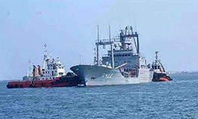
Iranian ships stranded, Lanka fears US sanctions
-

 Latest News3 days ago
Nissanka’s return headlines Sri Lanka’s Test squad against Pakistan
-

 News6 days ago
Interdicted top House official Kularatne receives special recognition in Mexican Parliament
-
 Features4 days ago
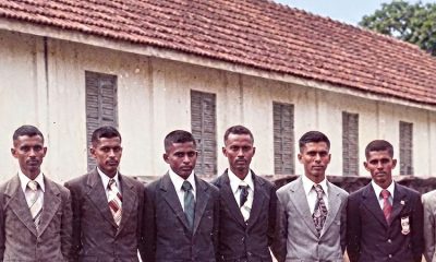
Intake 16: 45 years of duty and honour