
Weather
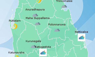
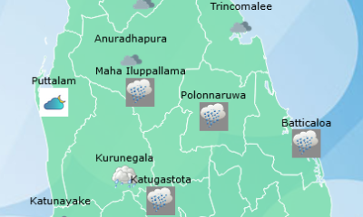
Heavy showers above 100 mm are likely at some places in Northern, North-central, Eastern and North-western provinces

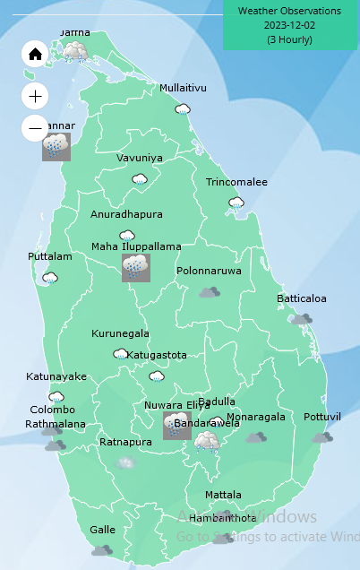
Weather forecast issued at 05.30 a.m.on 02 December2023 by the Department of Meteorology
The Depression over Southwest Bay of Bengal which was located near latitude 10.3°N and longitude 85.3°E, and about 490 km northeast of Trincomalee at 2330hrs on 01 December will develop into a deep depression during next 12hrs and further into a Cyclonic storm by December 03, 2023. The system is expected to move west northwestward near the North coast of Sri Lanka and towards the North Tamil Nadu coast of India by December 05, 2023.
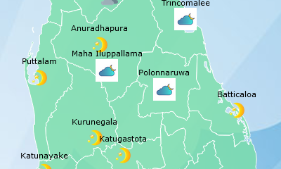
Cloudy skies can be expected over most parts of the island.
Showers or thundershowers will occur at times in Northern, North-central, Eastern and North-western provinces and heavy showers above 100 mm are likely at some places. Showers or thundershowers will occur at several places in other provinces of the island after 01.00 p.m. Showers may occur in Southern and Western province during the morning too.
Strong winds about (40-50) kmph can be expected at times over the Northern, North-central, Northwestern and Southern provinces and in Trincomalee and Batticaloa districts.
Winds will be north-westerly or westerly and wind speed will be (30-40) kmph in the sea areas around the island. Wind speed may increase up to (60-70) kmph in the sea areas off the coast extending from Mannar to Pottuvil via Kankasanthurai, Trincomalee and Batticaloa and up to (50-60) kmph in the sea areas off the coast extending from Galle to Pottuvil via Hambantota.
The sea areas off the coast extending from Mannar to Pottuvil via Kankasanthurai, Trincomalee and Batticaloa will be very rough at times while he sea areas off the coast extending from Galle to Pottuvil via Hambantota can be rough at times and the other sea areas around the Island can be fairly rough at times but temporarily strong gusty winds and very rough seas can be expected during thundershowers.
The general public is kindly requested to take adequate precautions to minimize damages caused by temporary localized strong winds and lightning during thundershowers.







Latest News
Landslide Early Warnings issued to the districts of Colombo, Galle, Gampaha, Hambanthota, Kalutara, Kandy, Kegalle, Kurunegala, Matara, Nuwara Eliya and Ratnapura

The National Building Research Institute has issued landslide early warnings to the districts of Colombo, Galle, Gampaha, Hambanthota, Kalutara, Kandy, Kegalle, Kurunegala, Matara, Nuwara Eliya and Ratnapura from 16:00 hrs on 25.09.2026 To 16:00 hrs on 26.09.2026
Accordingly,
LEVEL III [RED] landslide early warnings have been issued to the Divisional Secretaries Divisions and surrounding areas of Neluwa, Nagoda, Niyagama and Thawalama inthe Galle district, Ganga Ihala Korale, Udapalatha, Doluwa and Pasbage Korale in the Kandy district, and Kothmale West, Ambagamuwa, Kotmale East and Norwood in the Nuwara Eliya district.
LEVEL II [AMBER] landslide early warnings have been issued to the Divisional Secretaries Divisions and surrounding areas of Elpitiya, Baddegama and Karandeniya in the Galle district, Walallawita in the Kalutara district, Deltota, Udunuwara, Gangawata Korale, Yatinuwara and Panvila in the Kandy district, Aranayake, Dehiowita, Mawanella, Deraniyagala and Yatiyanthota in the Kegalle district, Thalawakelle in the Nuwara Eliya district and Ratnapura and Pelmadulla in the Ratnapura district.
LEVEL I [YELLOW] landslide early warnings have been issued to the Divisional Secretaries Divisions and surrounding areas of Seethawaka and Padukka in the Colombo district, Attanagalla and Mirigama in the Gampaha district, Katuwana and Walasmulla in the Hambanthota district, Ingiriya and Bulathsinhala in the Kalutara district, Hatharaliyadda, Poojapitiya, Medadumbara, Kundasale, Ududumbara, Thumpane, Akurana, Pathadumbara, Harispattuwa and Pathahewaheta in the Kandy district, Warakapola, Bulathkohupitiya, Galigamuwa, Kegalle and Ruwanwella in the Kegalle district, Mallawapitiya, Alawwa, Polgahawela and Mawathagama in the Kegalle district, Pitabeddara, Kotapola and Pasgoda in the Matara district, Nuwara Eliya in the Nuwara Eliya district and Elapatha, Ayagama, Nivithigala, Kuruwita and Kalawana in the Ratnapura district
Weather
Showers in the Western, Uva and Sabaragamuwa provinces and in Galle, Matara, Kandy, Nuwara-Eliya, Batticaloa and Ampara districts.

WEATHER FORECAST FOR 26 SEPTEMBER 2026
Issued at 05.30 a.m. on 26 September 2026 by the Department of Meteorology
Showers will occur at times in the Western, Uva and Sabaragamuwa provinces and in Galle, Matara, Kandy, Nuwara-Eliya, Batticaloa and Ampara districts.
Showers or thundershowers will occur at a few places in the Uva province and in Batticaloa and Ampara districts after 2.00 p.m.
The general public is kindly requested to take adequate precautions to minimize damage caused by temporary localized strong winds and lightning during thundershowers.
Weather
Showers will occur at times in the Western, Sabaragamuwa, Southern, Central and North-western provinces

WEATHER FORECAST FOR 25 SEPTEMBER 2026
Issued at 05.30 a.m. on 25 September 2026 by the Department of Meteorology
The deep depression over the Bay of Bengal is weakening into a depression. The impact of this system on Sri Lanka’s weather is expected to gradually decrease from today.
Showers or thundershowers will occur at times in the Western, Sabaragamuwa, Southern, Central and North-western provinces. Fairly heavy showers above 75 mm are likely at some places in the above areas.
Fairly strong winds of about (30-40) kmph can be expected at times over the Western slopes of the Central hills, the North-central and North-western provinces and in Trincomalee, Hambantota and Matale Districts.
The general public is kindly requested to take adequate precautions to minimize damage caused by temporary localized strong winds and lightning during thundershowers.

Landslide Early Warnings issued to the districts of Colombo, Galle, Gampaha, Hambanthota, Kalutara, Kandy, Kegalle, Kurunegala, Matara, Nuwara Eliya and Ratnapura

Showers in the Western, Uva and Sabaragamuwa provinces and in Galle, Matara, Kandy, Nuwara-Eliya, Batticaloa and Ampara districts.

22A, Judicature Amendment Bills passed with 2/3 majority

TIN mandatory for key transactions from Nov. 1

Navy brings 25 Indonesian fishermen ashore after trawler capsizes

Former Mineral Sands Chairman arrested over recruitment irregularities

‘Dates have the highest sugar content to fight Coronavirus’

Sunday Island 27 December – Headlines

#SundayIsland 17th December – Headlines

Sunday Island – 28th March

Sunday Island Headlines – 21 March

Sunday Island – 21st February – Headlines
-

 News6 days ago
Namal Rajapaksa Buddhist gambit fails, bail denied
-
 Features6 days ago
Why the spelling Sri Lankan names in English vary
-

 Features6 days ago
Three bands, a new identity: Sri Lankan wolf snake recognised as distinct species
-

 Business6 days ago
SLIIT holds largest-ever convocation
-

 News6 days ago
Vehicle prices drop by up to Rs. 1 mn, says importers’ body
-

 News6 days ago
Govt monitors reported Saudi death sentence – Foreign Ministry
-
 Business6 days ago
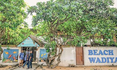
Lanka’s famed beach shack battles demolition
-

 Business6 days ago
All-new Bolero MaXX Pik-Up unveiled in Lanka