Weather
Showers or thundershowers will occur over most parts of the island after 2.00 p.m
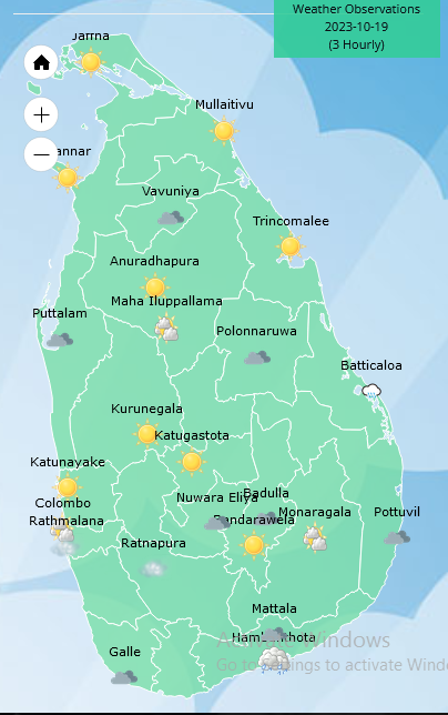
Weather forecast issued at 05.30 a.m. on 19 October 2023 by the Department of Meteorology
The prevailing rainy condition over the island is expected to continue further. Showers will occur in Western, Southern, Northwestern and Eastern provinces during the morning and showers or thundershowers will occur over most parts of the island after 2.00 p.m. Fairly heavy showers above 75 mm can be expected at some places in Western, Northwestern, Southern, Central and Eastern provinces.
Winds will be south-westernly or variable in direction and wind speed will be (20-30) kmph.
The sea areas around the island will be slight.
The general public is kindly requested to take adequate precautions to minimize damages caused by temporary localized strong winds and lightning during thundershowers.
A low-pressure area is likely to develop over central parts of Bay of Bengal from 20th October. Fishing and naval community are requested to be attentive to future forecasts issued by the Department of Meteorology in this regard.


Latest News
Landslide RED warnings issued to the Divisional Secretaries Divisions of Ududumbara, Nildadndahinna and Walapane

The landslide early warning center of the National Building Research Organisation [NBRO] has issued RED warnings to the districts of Kandy and Nuwara Eliya for the next 24 hours effective from 0900 hrs today [09th January].
Accordingly,
LEVEL III RED landslide early warnings have been issued to the Divisional Secretaries Divisions and surrounding areas of Ududumbara in the Kandy district, and Nildandahinna and Walapane in the Nuwara Eliya district.
LEVEL II AMBER landslide early warnings have been issued to the Divisional Secretaries Divisions and surrounding areas of Wilgamuwa in the Matale district, and Mathurata and Hanguranketha in the Nuwara Eliya district.
LEVEL I YELLOW landslide early warnings have been issued to the Divisional Secretaries Divisions and surrounding areas of Uva Paranagama, Welimada, Kandaketiya, Badulla, Meegahakiwula, Hali_Ela, Passara and Lunugala in the Badulla district, Minipe in the Kandy district, Ambanganga Korale, Ukuwela, Rattota, Naula and Laggala_Pallegama in the Matale district, and Nuwara Eliya in the Nuwara Eliya district.
Latest News
The deep depression to the South-east of Sri Lanka is likely to intensify in to a cyclonic storm during the next 24 hours

A RED warning for a deep depression to the South-east of Sri Lanka has been issued at 01.00 a.m. on 09 January 2026 for the period until 01.00 a.m. 10 January 2026 by the Natural Hazards Early Warning Centre, of the Department of Meteorology.
The deep depression in the Bay of Bengal to the southeast of Sri Lanka (At 01:00 a.m. on Jan 9th, 2026 located about 200 km East of Pottuvil) is very likely to intensify further and move west-northwestwards towards the coast of Sri Lanka between Pottuvil and Trincomalee in the evening today (9th January 2026.) The system is likely to intensify in to a cyclonic storm
during the next 24 hours.
Hence, showery, and windy condition over the island, particularly in the Northern, North-Central, Eastern, Uva and Central provinces is expected to enhance.
Weather
Showers above 100 mm are likely at some places in the Northern, North-central provinces and in Matale, Trincomalee and Puttalam districts

WEATHER FORECAST FOR 09 JANUARY 2026
Issued at 05.30 a.m. on 09 January 2026 by the Department of Meteorology
The deep depression in the Bay of Bengal to the southeast of Sri Lanka (At 04:00 a.m. on Jan 9th, 2026 located about 200 km South east of Batticaloa) is very likely to intensify further and move northwestwards towards the coast of Sri Lanka between Pottuvil and Trincomalee in the evening today, the 9th January 2026.
Cloudy skies can be expected over most parts of the island.
Showers or thundershowers will occur at times in the Northern, North-central, Eastern, Uva, Central and North-western provinces. Showers or thundershowers may occur at several places elsewhere during evening or night.
Heavy showers above 100 mm are likely at some places in the Northern, North-central provinces and in Matale, Trincomalee and Puttalam districts.
Fairly heavy showers about (50-75) mm are likely at some places in Kandy, Nuwara-Eliya and Batticaloa districts.
Very strong winds at times about (50-60) kmph and gusting up to 70 kmph can be expected at times over the Eastern slopes of the central hills, Northern, North-central, North-western, Central, Uva, and Eastern provinces and in Gampaha and Colombo districts.
The general public is kindly requested to take adequate precautions to minimize damages caused by temporary localized strong winds and lightning during thundershowers.

Rain washes out 2nd T20I in Dambulla

Colombia sees ‘real threat’ of US military action, president tells BBC

Landslide RED warnings issued to the Divisional Secretaries Divisions of Ududumbara, Nildadndahinna and Walapane

Harmanpreet, Mandhana return to DY Patil, on opposite sides this time

Huge anti-government protests in Tehran and other Iranian cities, videos show

Clinical Pakistan look to keep momentum going and wrap up series

‘Dates have the highest sugar content to fight Coronavirus’

Sunday Island 27 December – Headlines

#SundayIsland 17th December – Headlines

Sunday Island – 28th March

Sunday Island Headlines – 21 March

Sunday Island – 21st February – Headlines
-

 News4 days ago
Interception of SL fishing craft by Seychelles: Trawler owners demand international investigation
-

 News4 days ago
Broad support emerges for Faiszer’s sweeping proposals on long- delayed divorce and personal law reforms
-

 Opinion22 hours ago
The minstrel monk and Rafiki, the old mandrill in The Lion King – II
-

 Features22 hours ago
The Venezuela Model:The new ugly and dangerous world order
-

 News3 days ago
Prez seeks Harsha’s help to address CC’s concerns over appointment of AG
-

 News5 days ago
Private airline crew member nabbed with contraband gold
-

 Latest News2 days ago
Warning for deep depression over South-east Bay of Bengal Sea area
-

 News3 days ago
Govt. exploring possibility of converting EPF benefits into private sector pensions