News
Indian Ocean temps vary from side to side
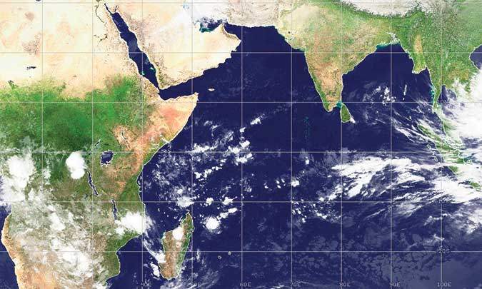
New research on the Indian Ocean dipole shows how melting ice water from massive glaciers can ultimately lead to droughts and flooding in East Africa and Indonesia.With a new analysis of long-term climate data, researchers say they now have a much better understanding of how climate change can cause sea water temperatures on one side of the Indian Ocean to be so much warmer or cooler than the temperatures on the other—a phenomenon that can lead to sometimes deadly weather-related events like megadroughts in East Africa and severe flooding in Indonesia.
The analysis, described in a new study in Science Advances, compares 10,000 years of past climate conditions reconstructed from different sets of geological records to simulations from an advanced climate model.
The findings show that about 18,000 to 15,000 years ago, as a result of melted freshwater from the massive glacier that once covered much of North America pouring into the North Atlantic, ocean currents that kept the Atlantic Ocean warm weakened, setting off a chain of events in response. The weakening of the system ultimately led to the strengthening of an atmospheric loop in the Indian Ocean that keeps warmer water on one side and cooler water on the other.
This extreme weather pattern, known as a dipole, prompts one side (either east or west) to have higher-than-average rainfall and the other to have widespread drought. The researchers saw examples of this pattern in both the historical data they studied and the model’s simulation. They say the findings can help scientists not only better understand the mechanisms behind the east-west dipole in the Indian Ocean, but also one day help to produce more effective forecasts of drought and flood in the region.
“We know that in the present-day gradients in the temperature of the Indian Ocean are important to rainfall and drought patterns, especially in East Africa, but it’s been challenging to show that those gradients change on long time-scales and to link them to long-term rainfall and drought patterns on both sides of the Indian Ocean,” says James Russell, a study author and professor of earth, environmental, and planetary sciences at Brown. “We now have a mechanistic basis to understand why some of the longer-term changes in rainfall patterns in the two regions have changed through time.”
In the paper, the researchers explain the mechanisms behind how the Indian Ocean dipole they studied formed and the weather-related events it led to during the period they looked at, which covered the end of the last Ice Age and the start of the current geological epoch.
The researchers characterize the dipole as an east-west dipole where the water on the western side—which borders modern day East African countries like Kenya, Ethiopia, and Somalia—is cooler than the water on eastern side toward Indonesia. They saw that the warmer water conditions of the dipole brought greater rainfall to Indonesia, while the cooler water brought much drier weather to East Africa.
That fits into what is often seen in recent Indian Ocean dipole events. In October, for example, heavy rain led to floods and landslides in Indonesian islands of Java and Sulawesi, leaving four people dead and affecting over 30,000 people. On the opposite end, Ethiopia, Kenya, and Somalia experienced intense droughts starting in 2020 that threatened to cause famine.
The changes the authors observed 17,000 years ago were even more extreme, including the complete drying of Lake Victoria—one of the largest lakes on Earth.
“Essentially, the dipole intensifies dry conditions and wet conditions that could result in extreme events like multi-year or decades-long dry events in East Africa and flooding events in South Indonesia,” says Xiaojing Du, a postdoctoral researcher in the Institute at Brown for Environment and Society and Brown’s department of earth, environmental and planetary sciences, and the study’s lead author. “These are events that impact people’s lives and also agriculture in those regions. Understanding the dipole can help us better predict and better prepare for future climate change.”
The dipole the researchers studied formed from the interactions between the heat transport system of the Atlantic Ocean and an atmospheric loop, called a Walker Circulation, in the tropical Indian Ocean. The lower part of the atmospheric loop flows east to west across much of the region at low altitudes near the ocean surface, and the upper part flows west to east at higher altitudes. The higher air and lower air connect in one big loop.
Interruption and weakening of the Atlantic Ocean heat transport, which works like a conveyor belt made of ocean and wind currents, was brought on by massive melting of the Laurentide ice sheet that once covered most of Canada and the northern US. The melting cooled the Atlantic and consequent wind anomalies triggered the atmospheric loop over the tropical Indian Ocean to become more active and extreme. That then led to increased precipitation in the east side of the Indian Ocean (where Indonesia sits) and reduced precipitation in the west side, where East Africa sits.
The researchers also show that during the period they studied, this effect was amplified by a lower sea level and the exposure of nearby continental shelves.
The scientists say more research is needed to figure out exactly what effect the exposed continental shelf and lower sea level has on the Indian Ocean’s east-west dipole, but they’re already planning to expand the work to investigate the question. While this line of the work on lower sea levels won’t play into modeling future conditions, the work they’ve done investigating how the melting of ancient glaciers impacts the Indian Ocean dipole and the heat transport system of the Atlantic Ocean may provide key insights into future changes as climate change brings about more melting.
“Greenland is currently melting so fast that it’s discharging a lot of freshwater into the North Atlantic Ocean in ways that are impacting the ocean circulation,” Russell says. “The work done here has provided a new understanding of how changes in the Atlantic Ocean circulation can impact Indian Ocean climate and through that rainfall in Africa and Indonesia.”
The study had funding from the Institute at Brown for Environment and Society and the National Science Foundation.

Protesting Development Officers continued their hunger strike near the Presidential Secretariat, Colombo yesterday (01), for the seventh consecutive day.The protesters, who are members of the Lanka School Development Officers’ Association, are demanding that they be absorbed into the teacher service as they have served as teachers in state-run schools for nearly seven years.
Secretary of the Association, Viraj Manaranga, said the protesters were seeking an urgent meeting with the President. He added that a presidential aide had visited the protest site and offered to arrange for a meeting with the President on 03 Feb., but the union insisted on an earlier date. Manaranga warned that failure to grant a meeting could trigger a massive protest in Colombo today (02).
Four officers participating in the hunger strike have been hospitalised due to deteriorating health, while two more joined the fast on Saturday (31).
In a bid to raise awareness of their grievances, on 30 January a delegation of the All Island Development Officers’ Association visited Most Venerable
Warakagoda Sri Gnanarathana Thera, Mahanayake of the Asgiriya Chapter, and subsequently with the Chapter’s Registrar, Ven. Dr. Medagama Dhammananda Thera. The prelates said promises that had been made to them should be fulfilled.
The protest began on 26 January as a satyagraha, after authorities failed to respond to repeated requests to integrate the officers into the teaching service. The escalation into a fast-unto-death underscores the protesters’ frustration over the prolonged delay
by Pradeep Prasanna Samarakoon
The long-vacant post of Auditor General would be filled on 03 Feb., after months of controversy and delays, Minister of Transport, Highways and Urban Development Bimal Rathnayake said on Friday (31) in Kandy.
The Constitutional Council met at the Parliamentary complex on Friday to discuss the appointment but failed to reach a decision on a suitable candidate. The President had previously proposed four names on four separate occasions, all of which were rejected. The Council is now set to consider the fifth nominee.
The post has remained vacant since April 2025, following the retirement of Chulanta Wickramaratne, who served as the 41st Auditor General. More than 10 months have passed without a permanent appointment.
Sources said a female officer in the Auditor General’s Department has been nominated again, though her previous recommendation was rejected due to some allegations against her.
Meanwhile, senior audit officer Dharmapala Gammanpila, with 31 years of service and the department’s most senior official, has received backing from the Mahanayake Theras of the three Nikayas, the Maha Sangha, and several civil society groups for appointment as the 42nd Auditor General.
Sources noted that the three civil society representatives on the Constitutional Council will play a crucial role in the final decision.
by Chaminda Silva and SK Samaranayake

Two 18-year-old youth were arrested by the Southern Division of the Western Province Crime Division on 31 January for allegedly aiding and abetting two murders carried out in Dehiwala and Kohuwala. ICE (crystal meth) was found in their possession at the time of arrest.
The suspects are residents of Mount Lavinia and Boralesgamuwa, according to the police. They are accused of having helped carry out a murder at a hotel in the Dehiwala Police Division on 9 January, 2026, and an attack on a person travelling in a three-wheeler at Bodhiyawatta, Kohuwala, on 12 December, 2025.
Police said the charges included sending photographs of the victims to a criminal living overseas.
Investigations revealed that the youth had acted under the direction of a criminal known as Sando.
Under the guidance of Janaka Kumara, Director of the Southern Division of the Western Province Crime Division, investigations are being led by Police Inspector Hemanta Kumara, assisted by Sub-Inspectors Prasanna Gunathilaka and Prasanna (40248), and Constables Chaminda (72987), Anil (79598), Kumar (88762), and Senanayake (19363), who are continuing the probe.
by Norman Palihawadane and Chaminda Silva

Showers expected in the Northern, North-central, Eastern, Western, Uva, Sabaragamuwa, Southern and Central provinces

Development Officers threaten to intensify their protest

Auditor General to be appointed tomorrow

Two arrested for aiding and abetting murder

CID summons former First Lady again

Remembering Upali Wijewardene, founder of Upali Group of Companies

‘Dates have the highest sugar content to fight Coronavirus’

Sunday Island 27 December – Headlines

#SundayIsland 17th December – Headlines

Sunday Island – 28th March

Sunday Island Headlines – 21 March

Sunday Island – 21st February – Headlines
-
 Business4 days ago
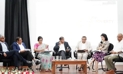
Climate risks, poverty, and recovery financing in focus at CEPA policy panel
-

 Opinion3 days ago
Sri Lanka, the Stars,and statesmen
-

 Business2 days ago
Hayleys Mobility ushering in a new era of premium sustainable mobility
-

 Business2 days ago
Advice Lab unveils new 13,000+ sqft office, marking major expansion in financial services BPO to Australia
-

 Business2 days ago
Arpico NextGen Mattress gains recognition for innovation
-

 Business1 day ago
Altair issues over 100+ title deeds post ownership change
-

 Business1 day ago
Sri Lanka opens first country pavilion at London exhibition
-

 Editorial2 days ago
Govt. provoking TUs