News
Indian scientists begin a voyage to map the Indian Ocean genome

BY S VENKAT NARAYAN
Our Special Correspondent
NEW DELHI, March 12:
A 30-member team of scientists and researchers from the National Institute of Oceanography (NIO) in Panaji (Goa) and another 30 crew members onboard its research vessel Sindhu Sadhana were flagged off at Visakhapatnam (also known as Vizag) in Andhra Pradesh on Thursday on a first-of-its-kind research project in this country to map the Indian Ocean genome.
They will spend the next three months traversing the course of over 10,000 nautical miles in the Indian Ocean on a research project to reveal the internal working of the body of the ocean at a cellular level.
The research project is aimed at understanding the biochemistry and the response of the ocean to climate change, nutrient stress and increasing pollution. Conceptualised over the last two to three years, the research project has been undertaken at a cost of INR 250 million and will take three years to complete, NIO Director Sunil Kumar Singh said.
The scientists and researchers, including six women, will sail across the Indian Ocean from India’s east coast, all the way to Australia, then onward towards Port Louis in Mauritius and up to the border of Pakistan, off India’s west coast. They will gather samples for genome mapping of microorganisms in the Indian Ocean. They will collect samples from various stretches of the ocean at an average depth of about 5 km.
Just like gene-mapping is carried out on blood samples collected from humans, the scientists will map these in the bacteria, microbes found in the ocean. The mapping of the Deoxyribonucleic acid (DNA) and Ribonucleic acid (RNA) will show the nutrients present in them, and also those lacking in different parts of the ocean.
NIO Director Singh says this will help scientists understand the internal working of the ecosystem of the Indian Ocean. The research will enable scientists to identify the factors controlling the changes in RNA, DNA in the oceans, and various stressors impacting them.
The ocean has several micronutrients like nitrates, sulphates and silicates, minerals like iron ore and zinc, and trace metals like cadmium or copper. The genome mapping will show the presence of which these microbes have adapted to, in addition to their reaction to atmospheric carbon dioxide. This will help in identifying which part of the ocean has a greater concentration of which mineral or element.
The scientists will then use these as tracers to tackle the causative factors for excess or lack of a certain mineral or element and suggest possible solutions for their mitigation. In addition, the large pool of RNA, DNA library of the oceans will be utilised for using the Indian Ocean to human benefit in the future.
According to the NIO, rapid advances in sequencing technologies and bioinformatics have enabled exploration of the ocean genome. “Exploring the ocean genome will enable an increase in the growing number of commercial biotechnology applications, extending from multiple anticancer treatments to cosmetics and industrial enzymes, to antiviral molecules… Exploration of the ocean at a genetic level will result in new insights into taxonomy and adaptive capacity that can help optimize conservation efforts,” the NIO said in its project abstract.
Trace metals like cadmium or copper are supplied to oceans via continental run-offs, atmospheric deposition, hydrothermal activities and continental shelf interaction. They are essential for ocean productivity. Scientists say that it is important to understand the interactions of trace metals with marine biota “for having a holistic understanding about nutrient cycling and productivity of the oceans”.
Apart from their reactions on marine life, isotopic forms of trace metals can be utilised to track the movement of water masses responsible for ocean circulation and as tools to study the biological, geochemical and ecosystem processes and food web analyses.
The NIO’s project is expected to generate new information about trace metals from underexplored regions of the Indian Ocean, the third largest water body in the world, covering about 20 per cent of the Earth’s water surface.
The team of scientists will stay aboard their research vessel for about 90 days with refuelling scheduled at Mauritius. The route is from Visakhapatnam to the mouth of the Ganga then down the ocean to Australia, then westward to Mauritius and up to the Pakistan border. At various stages and stretches, samples will be collected by lowering a Kevlar cable of up to 8 km with a set of 24 teflon coated bottles to collect samples. They have a capacity of 12 litres.
The Kevler cable and the Teflon coating are to ensure that metals are not inadvertently introduced into the water by the vessel itself. The samples will be collected and the bacteria will be stored at -60 degrees Celsius with the help of liquid nitrogen. While some samples will be tested at six laboratories on board the vessel, several samples will be brought back to NIO for study and analysis over the next three years.
Latest News
Do not be misled by Fake news created using the PM’s name, photographs, and video footage – Prime Minister’s Media Division

It has been revealed that fake news created using the name, photographs, and video footage of Prime Minister Dr. Harini Amarasuriya along with the unauthorized use of official logos of various media institutions and news websites are being circulated on social media platforms.
Certain groups have published videos edited to appear as though the Prime Minister is expressing particular views, as well as fake social media posts featuring her photographs. Through such misleading content, false information has been circulated regarding various business and employment opportunities, as well as the country’s economy and tax policies.
These false stories have been created using Artificial Intelligence (AI) and modern technological tools. As the Prime Minister’s Media Division, we kindly urge the public not to be deceived by such misinformation and to remain vigilant regarding these matters.
Legal action will be taken against all individuals who create and distribute such false news through social media in a manner that harms the Government and the reputation of the Prime Minister.
[Prime Minister’s Media Division]
News
New High-Definition (HD) Television Studio at the University of Vocational Technology handed over to students with the participation of the Prime Minister
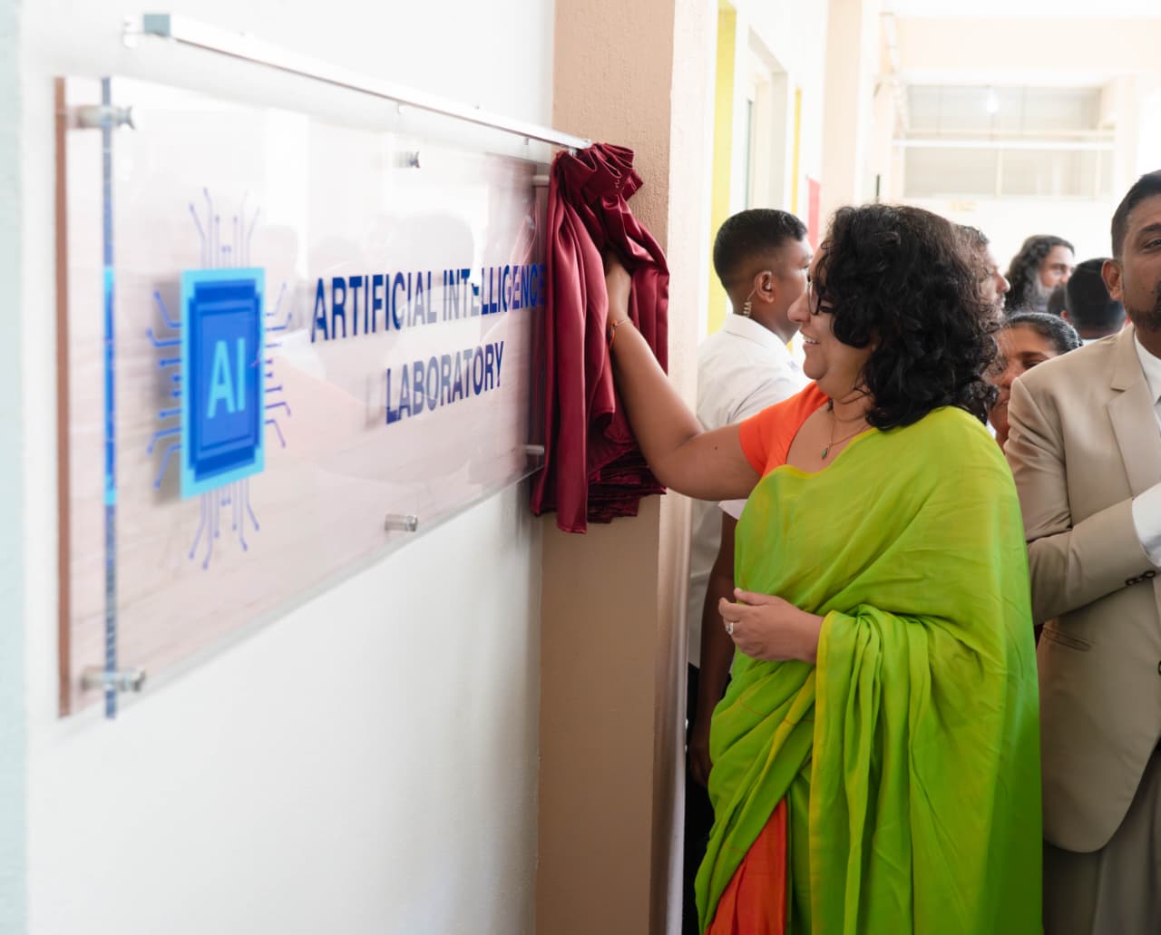
The newly equipped television studio, which had remained an incomplete component of the media complex constructed for the practical training of students at the University of Vocational Technology (UoVT), Ratmalana, was officially handed over to the students on Tuesday (26 May) with the participation of Prime Minister Dr. Harini Amarasuriya, following the installation of modern technological equipment and studio production facilities.
Following the opening of the television studio, several newly established affiliated centres aimed at expanding students’ practical and academic activities were also declared open.
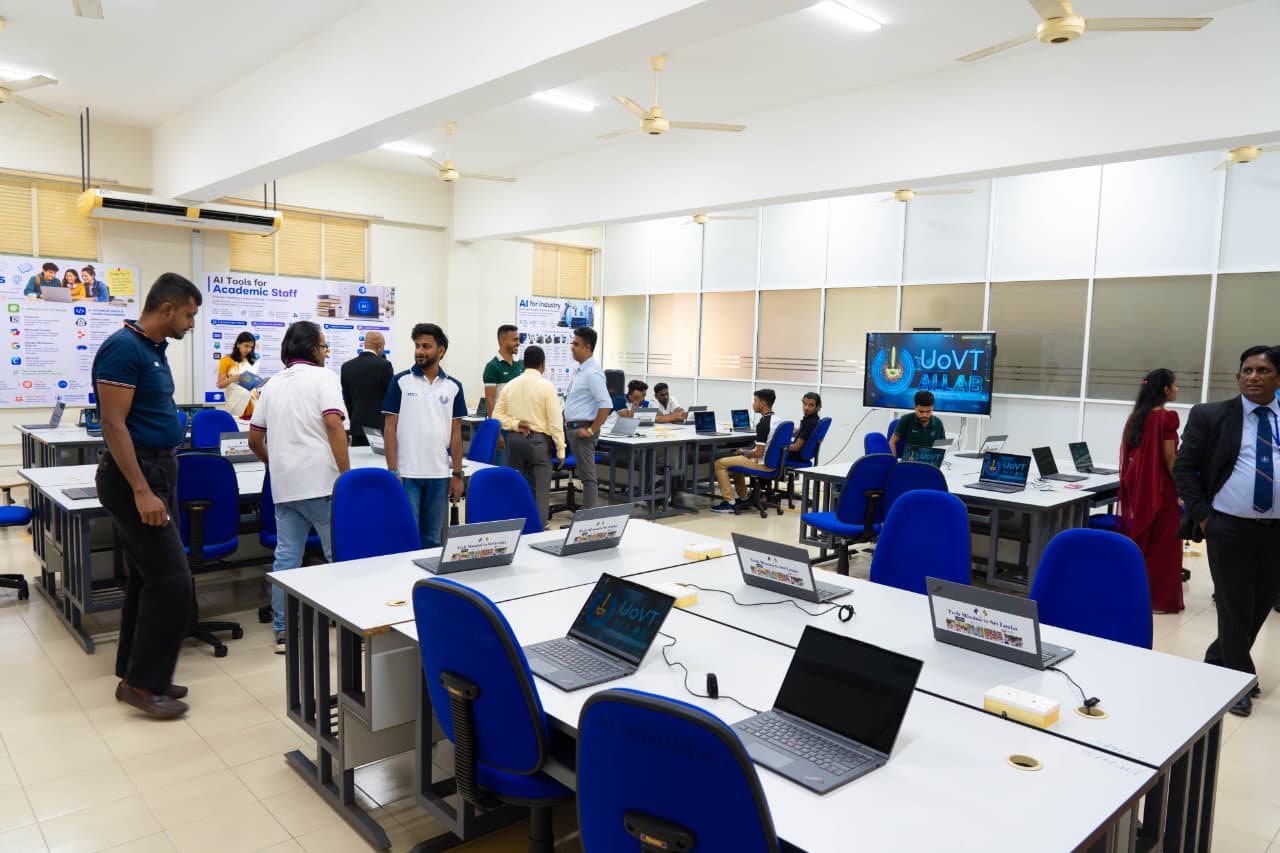
Accordingly, a broadcasting studio providing opportunities for students to launch a range of educational services, including a web radio channel, an Artificial Intelligence Research Laboratory, and a Centre for Gender, Equity and Equality were inaugurated during the occasion.
Coinciding with the event, laptop computers were donated to support the uninterrupted continuation of the educational activities of students in at several schools affected by the recent floods and other natural disasters. In addition, the “UoVT Greening Policy,” formulated with a comprehensive understanding of technology and environmental inter connectivity, was officially launched during the occasion.
Following this policy, all construction and development activities within the university are expected to be carried out based on green concepts, with the goal of transforming the university into a carbon-neutral environmental unit by the year 2030.
One of the key objectives of this initiative is to encourage students pursuing vocational education to engage more actively in employment opportunities within industries that prioritise green concepts and sustainability.
Following the event, the Prime Minister also engaged in a discussion with representatives of the university student unions.
The event was attended by the Deputy Minister of Vocational Education Nalin Hewage, Secretary to the Ministry of Education, Higher Education and Vocational Education Nalaka Kaluwewa, Vice Chancellor of the University of Vocational Technology, Professor K.M.G. Prasanna Premadasa, along with several distinguished invitees.
[Prime Minister’s Media Division]
Sri Lanka’s banking sector has provided a collective and categorical assurance that it remains stable, resilient, and secure despite a few recent isolated incidents of financial fraud, emphasising that these developments do not pose a threat to the safety of customer deposits or the overall integrity of the financial system.
While acknowledging that such incidents have understandably generated some concerns, the industry has reiterated that it is addressing these matters comprehensively and that it is well equipped to manage and mitigate these challenges. This assurance was conveyed in a statement issued to the media by the Sri Lanka Banks’ Association (SLBA), which represents all licensed commercial banks in the country.
Addressing recent reports of financial fraud and cyber-related incidents that have drawn heightened public attention, the Association underscored the strength of the sector’s fundamentals and the effectiveness of ongoing regulatory oversight and risk management frameworks.
“Recent reports of financial fraud and cyber-related incidents have understandably received public attention. Industry leaders and regulators emphasise, however, that the banking sector remains fundamentally strong, resilient, and well equipped to withstand such challenges, without compromising its core stability or the security of customer deposits,” the Chairman of the SLBA Sanath Manatunge stated.
He noted that while many social media posts are either misleading or carry inaccurate information, some recent cases, including electronic fund transfer fraud, have raised important questions about digital security. However, these incidents represent only a very small proportion relative to the substantial institutional capital buffers maintained by banks. Importantly, depositors are assured that customer funds remain secure, with any such losses being absorbed through institutional capital buffers rather than public deposits.
Other cybercrime cases reported in recent months, including phishing-related fraud which are not directly connected to the banking industry and hence do not manifest any vulnerabilities in the system, however underscore the evolving and increasingly sophisticated nature of digital threats faced by financial systems worldwide, the Chairman said, but stressed that these are isolated incidents and do not reflect systemic weaknesses across the banking industry.
Reinforcing this position, the Central Bank of Sri Lanka has confirmed that all licensed banks continue to maintain capital adequacy and liquidity ratios well above minimum regulatory requirements, the Association pointed out. The regulator has also reiterated its readiness to provide temporary liquidity support if required, ensuring the uninterrupted stability of the financial system.
“Sri Lanka’s banking sector collectively manages trillions of rupees in assets, supported by diversified portfolios and robust governance frameworks. This scale, combined with prudent risk management practices, provides a strong foundation for absorbing shocks while maintaining public confidence,” Manatunge said.
At the same time, the industry is actively strengthening its defences against emerging threats. Banks are continuously enhancing cybersecurity frameworks through investments in advanced Fraud Risk Management Systems, more rigorous monitoring protocols, and independent forensic audits. These efforts are complemented by ongoing regulatory and parliamentary initiatives aimed at strengthening governance, accountability, and transparency across the sector.
Recognising that customer awareness is a critical line of defence, banks have also intensified public education initiatives focused on safe digital practices. These include guidance on password security, phishing prevention, and the secure use of QR codes and other digital payment tools.
The SLBA noted that cyber fraud is not unique to Sri Lanka, with similar incidents reported in major economies around the world. In these markets, banking systems have remained stable, supported by strong regulatory oversight and continuous adaptation to emerging risks. Sri Lanka’s banking industry is demonstrating comparable resilience, with swift corrective measures and vigilant supervision reinforcing confidence in the system.
While recent incidents have highlighted certain challenges in the environment, the benefits of digital banking far outweigh such concerns, Manatunge added, reiterating that Sri Lanka’s financial sector remains robust, well-capitalised, and subject to close regulatory oversight. These incidents are isolated in nature and do not indicate systemic failure, and the corrective measures already underway are expected to further strengthen the sector’s resilience against future threats.
The SLBA concluded: “Sri Lanka’s banks continue to stand as pillars of stability, safeguarding customer deposits while supporting the country’s economic progress. We urge customers to remain vigilant in their own digital practices, even as the industry continues to enhance the safeguards that protect them.”

Five people found alive after week trapped in flooded Laos cave

Peace deal to fully reopen Hormuz as US military pulls out

World Cup contenders England and India hope to get their combinations right

Do not be misled by Fake news created using the PM’s name, photographs, and video footage – Prime Minister’s Media Division

Israeli strike in Gaza City kills new head of Hamas’s military wing

Sri Lanka Cricket launch a program to enhance coaching standards of school cricket

‘Dates have the highest sugar content to fight Coronavirus’

Sunday Island 27 December – Headlines

#SundayIsland 17th December – Headlines

Sunday Island – 28th March

Sunday Island Headlines – 21 March

Sunday Island – 21st February – Headlines
-

 Business6 days ago
Historic launch of CCWE Fashion Week & International Summit 2026
-
 Opinion7 days ago
Murder of Ehelepola family, Bogambara Wewa and Sightings of Wangediya
-
 News7 days ago
Steps underway to safeguard Sri Lanka’s maritime heritage
-

 News4 days ago
All-New GRAVITE launches at LKR 6.99 Mn
-
 News3 days ago
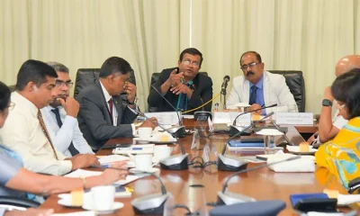
Police probe underway to ascertain links between criminals deported from UAE and local politicians
-
 Features4 days ago
The NPP’s pivot to the past
-

 Opinion6 days ago
The need to reform Buddhist ecclesiastical order
-
 News2 days ago
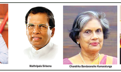
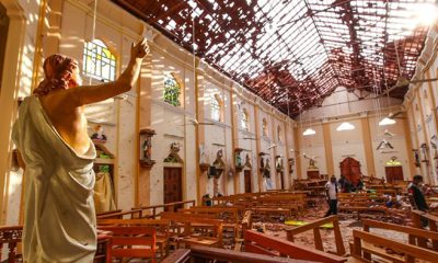
Easter Sunday carnage: Court told Maulana’s statement cannot be accepted without cross-examination