Weather
Strong winds over Eastern, Uva, Western, Central and Sabaragamuwa provinces and in Galle, Matara, Mullaitivu, Jaffna and Kilinochchi districts.

Weather forecast issued at 05.30 a.m. on 31 January 2023 by the Department of Meteorology
The depression over the Southeast and adjoining Southwest Bay of Bengal, lay centered near latitude 8.1°N and longitude 85.3°E, about 455 km east-southeast of Trincomalee. It is likely to move west-northwestwards till evening of 31st January then re-curve gradually south-southwestwards and cross Sri Lanka coast in the forenoon of 01st February 2023.
Showers or thundershowers will occur at times in Northern, Eastern, North-Central and Uva provinces and in Matale and Hambantota districts.
Sowers or thunder showers will occur at several places elsewhere during the afternoon or night.
Very heavy showers about 150mm are likely at some places in Eastern, Uva and Central provinces and in Polonnaruwa district. Heavy showers above 100mm are likely at some places in North-Western and Northern provinces and Anuradhapura district.
Strong winds about (50-60) kmph can be expected at times over the Eastern, Uva, Western, Central and Sabaragamuwa provinces and in Galle, Matara, Mullaitivu, Jaffna and Kilinochchi districts.
General public is kindly requested to take adequate precautions to minimize damages caused by temporary localized strong winds and lightning during thundershowers.
State of Sea:
There’s a possibility to increase swell waves (about 2.5 – 3.0 m height) off the coast extending from Pottuvil to Mannar via Batticaloa, Trincomalee and Kankasanthurai.
Sea areas around the Island will be rough and very rough at times.
It is advised not to venture into fishing and naval activities in the sea areas around the Island.
Weather
Showers may occur in Uva province and in Ampara, Batticaloa, Matale and Nuwara-Eliya districts

WEATHER FORECAST FOR 25 DECEMBER 2025
Issued at 05.30 a.m. on 25 December 2025 by the Department of Meteorology
Misty conditions can be expected at some places in Sabaragamuwa and Central provinces and in Kaluthara, Badulla, Galle and Matara districts during the early hours of the morning.
A few showers may occur in Uva province and in Ampara, Batticaloa, Matale and Nuwara-Eliya districts. Showers or thundershowers will occur at several places in Sabaragamuwa province and in Galle, Matara and Kaluthara districts after 2.00 p.m. Fairly heavy falls above 50 mm are likely at some places.
The general public is kindly requested to take adequate precautions to minimize damages caused by temporary localized strong winds and lightning during thundershowers.
Weather
Several spells of showers may occur in Central, Uva and Eastern provinces and in Polonnaruwa and Mullaittivu districts
WEATHER FORECAST FOR 24 DECEMBER 2025
Issued at 05.30 a.m. on 24 December 2025 by the Department of Meteorology
Misty conditions can be expected at some places in the Sabaragamuwa and Central provinces and in Kaluthara, Badulla, Galle and Matara districts during the early hours of the morning.
Several spells of showers may occur in Central, Uva and Eastern provinces and in Polonnaruwa and Mullaittivu districts. Showers or thundershowers will occur at a few places in the Southern province and in Kaluthara and Rathnapura districts after 2.00 p.m. Fairly heavy showers above 50 mm are likely at some places in Galle and Matara districts. Mainly fair weather will prevail in other areas of the island.
Weather
Showers may occur in the Uva and Eastern provinces and in Matale, Nuwara-Eliya, Polonnaruwa and Hambantota districts.
WEATHER FORECAST FOR 23 DECEMBER 2025
Issued at 05.30 a.m. on 23 December 2025 by the Department of Meteorology
Misty conditions can be expected at some places in the Sabaragamuwa and Central provinces and in Colombo, Kaluthara, Badulla, Galle and Matara districts during the early hours of the morning.
A few showers may occur in the Uva and Eastern provinces and in Matale, Nuwara-Eliya, Polonnaruwa and Hambantota districts. Showers or thundershowers may occur at a few places in the Ratnapura, Galle, Matara and Kalutara districts after 2.00 p.m. Mainly fair weather will prevail in the other areas of the island.

Showers may occur in Uva province and in Ampara, Batticaloa, Matale and Nuwara-Eliya districts

CoPF Chief steps up pressure on Prez to appoint AG

Indian HC and Consulates extend humanitarian assistance to families affected by Cyclone Ditwah

Sri Lanka prepares to deploy fresh military contingent under UN command

New measures to protect environmentally sensitive Sri Pada region

Chief selector’s remarks disappointing says Mickey Arthur

‘Dates have the highest sugar content to fight Coronavirus’

Sunday Island 27 December – Headlines

#SundayIsland 17th December – Headlines

Sunday Island – 28th March

Sunday Island Headlines – 21 March

Sunday Island – 21st February – Headlines
-

 News2 days ago
Members of Lankan Community in Washington D.C. donates to ‘Rebuilding Sri Lanka’ Flood Relief Fund
-

 Business6 days ago
Unlocking Sri Lanka’s hidden wealth: A $2 billion mineral opportunity awaits
-

 News6 days ago
Army engineers set up new Nayaru emergency bridge
-

 News6 days ago
TISL, civil society flay NPP govt. for holding up Auditor General’s appointment
-

 Latest News5 days ago
Landslide early warnings issued to the districts of Badulla, Kandy, Kurunegala, Matale and Nuwara-Eliya extended till 8AM on Sunday (21)
-

 Opinion6 days ago
The Maha Jana Handa at Nugegoda, cyclone destruction, and contenders positioning for power in post-NPP Sri Lanka – II
-

 Latest News6 days ago
Tannane goal from own half sets Morocco on way to FIFA Arab Cup 2025 title
-
 News6 days ago
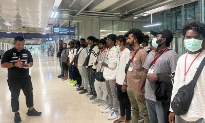
Sri Lankans rescued from cybercrime centers in Myanmar repatriated